Introduction to Unit 8: Web-based Environmental GIS
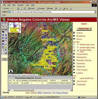
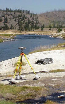
Figure 1: A GPS receiver in Yellowstone National Park and a Web GIS screen shot for a Web GIS support tool for communities along the Mexican/US border. Photos courtesy of USGS
This unit focuses on environmental data delivery – in other words, how GIS data and outputs are brought to the intended users. There are many modes of GIS data delivery, including the use of paper-based maps and reports, intra-net delivery, and face-to-face meetings. Recent developments in GIS and in the internet lead to the argument that another output method: Web-based GIS, is the most important one to discuss at the present time. In the past, it would have been difficult for members of the public to have scrutiny of the detail of GIS-based analyses to support environmental management. However, tools are beginning to emerge that make GIS-type functionality more accessible to the public, as we will see in this unit.
The unit contains the following sections:
- Web-based GIS: the design attributes
- Web-based data generated by the public
- Web-based GIS: professionals sharing data
The final three sections examine how GIS is used to deliver, share and generate data over the web, a rapidly changing area (see slideshow below). ‘Web-based GIS: the design attributes’ reviews how web-based GIS servers can deliver environmental data in the form of maps to the public. Do web-based GIS systems really place environmental decision-making in the hands of the general public, or do the most important data sets and GIS functions remain off-line and out of access? ‘Web-based data generated by the public’ looks at a very new phenomenon, how the public themselves can now collaboratively create, share, analyse, and edit environmental data. ‘Web-based GIS: professionals sharing data’ looks at recent GIS developments, through which GIS professionals can upload and share data with one another.