Currently browsing tag

visualisation

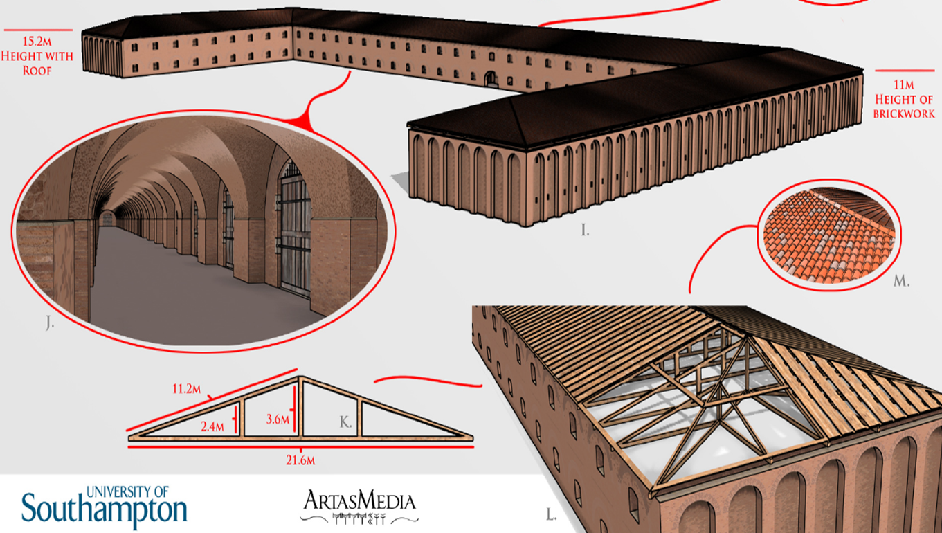
Build your own Portus

Modelling help sheet (Grant Cox and Christina Triantafillou) I’m very excited about the imagination shown in the comments on the Archaeology of Portus: exploring the lost harbour of ancient Rome course. But it is clear that even at this late stage it is still hard to get a sense of space. We’ve worked hard to film as much as possible of the MOOC content actually on-site at Portus last summer, and you can see where this footage was filmed. Hopefully this week will also help. Continue reading →

Reconstructing Portus – Rome’s Lost Empire

Why produce computer models? We have been producing computer graphic representations as part of our work at Portus since 2007. These are used for a number of purposes. Firstly, they help us to bring together all the many forms of digital data gathered on site, through survey, geophysics, photogrammetry, laser scanning and other tools. For example, we are combining three-dimensional geophysics with laser scans and excavated sections to understand the development of the Building 5. Continue reading →