Currently browsing tag

Portus Project, Page 2

Changing direction?

I’ve been doing a lot of thinking around my participation in the Portus MOOC a few weeks back. This post is an attempt to get my thoughts in order, so I apologise in advance for any disjointedness. First of all, let me edit in some thoughts on locatative gaming, prompted by a Guardian article on social gaming I read today while I should have been bashing this post into shape. Continue reading →

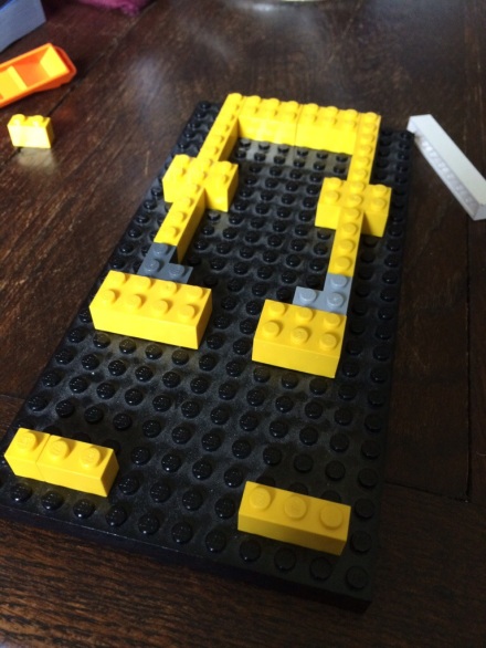
Why Lego? #buildyourownportus

I wrote a post for the Day of Archaeology blog. Much of it summarises, and refers back to, recent posts here about the Portus MOOC and #buildyourownportus. But this bit is new: But then I [...] had to make a visit to the Vyne a week or two ago, and they currently have on display a large Lego model, based on all the archaeological evidence of what that place looked like in its Tudor prime. Looking at this model. Continue reading →

Visualizing Portus #UoSFLPortus

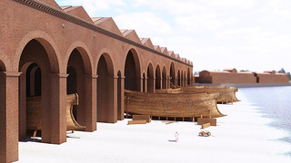
Right, I think I might have reached the limits of Lego Digital Designer. And I’m only about a third of the way through visualizing the Grandi Magazzini di Settimio Severo. I started with the excellent notes and drawings made by Grant Cox and Christina Triantafillou especially for as after a couple of us on the Portus MOOC started modelling building five. From that I created a Lego model of a single warehouse space – a guess a “Magazzino”. Continue reading →

New city wall discovered at Ostia

Newly discovered features at Ostia (Satellite imagery courtesy of Digital Globe Inc) Researchers from the universities of Southampton and Cambridge have discovered a new section of the boundary wall of the ancient Roman port of Ostia, proving the city was much larger than previously estimated. The team, led by Professor Simon Keay (Southampton) and Professor Martin Millet (Cambridge), has been conducting a survey of an area of land lying between Ostia and Portus. Continue reading →

Unmanned Aerial Vehicles at Portus

Parrot AR Drone at Portus Since the start of excavations by the Portus Project in 2007, aerial photography has played an important role in the recording, analysis and presentation of the research. The ability for the archaeologist to have a bird’s-eye view of an excavation gives the opportunity to see the plan of structures, their relationships with each and alignments which are not visible at ground level. Continue reading →