Currently browsing category

Archaeological Prospection Services of Southampton (APSS), Page 4

End of another week of magnetometry and topographic survey

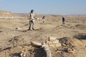
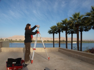
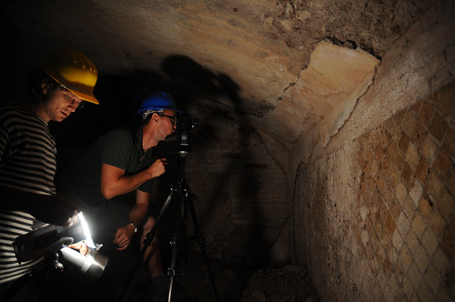
Another week of survey at Antinoupolis is at an end. This week work focused on survey in the area of the ancient city, between the northern corner of the walls and the east gate survey area from 2012. In addition Jay has spent the last few days starting a GPS topographic survey of the east gate and the hippodrome to the north-east of the city. Results of the hippodrome topography are looking impressive. Continue reading →

Visit to the Sheikh Ebada mosque and the tomb of Ebada Ibn Samet

Once again finding time to be able to write is getting difficult, with the survey work going on at a strong pace. Time for two blogs this evening, later on some updates on the survey, but for now a description of a short trip the team made the other evening to the mosque in Sheikh Ebada, and to the tomb of Ebada Ibn Samet. The mosuqe is located in t he northern part of Sheikh Ebada, aligned with the northern decumanus of the Roman city. Continue reading →

End of first phase of magnetometry – and a day off

Second blog of the day trying to catch up on over a week of missed writing. For the last four days the magnetometry has been continuing in the necropolis area of Antinoupolis. Work starts on site at 7am sharp, and we take a knackered old pick-up truck on a track roughly along the line of one of the decumani of the city, out to the Severian wall and up to the Coptic chapel of Theodosia adjacent to the Roman necropolis. Continue reading →

Antinoupolis Survey Magnetometry Commences

Trying to catch up with blog posts this week, on a slow internet connection and pushing the magnetometer survey forwards. Work is moving ahead with the survey of the necropolis of Antinoupolis. The area was gridded out last Saturday, with 10 hectares prepared, and the magnetometry has been moving forwards. The area in question is located between the north-western corner of the city, the Coptic cemetery to the west and the confines of the wadi to the north. Continue reading →

End of Theban survey and up to Antinoupolis

The internet connection at Sheikh Ebada near El Minya is terrible, so no blogging for the last week. This is the first time I have managed to get set up so there is plenty to write about. We finished the survey at Thebes on 7th February, and Angus and the team departed for the UK on the 8th. We caught up with some American colleagues before the end, and enjoyed an amazing view of the West Bank including Kom el Hetan, one of the focal points for the THaWS survey. Continue reading →

A new year at Portus

The New Year has begun auspiciously for all those of us involved with the Portus Project and related work. At one level, we are pushing ahead steadily with completion of the post-excavation work that will form the basis of the final reports on the project. In January, we held the first of three planned Workshops at the British School at Rome (BSR). This was organized by Christina Triantafillou and myself and was very well attended. Continue reading →

Geophysics at Karnak – Intensive GPR survey and the beginning of the end of the survey

The latest work on the THaWS project has been marked by the intensity of survey profiles and survey areas covered, andΒ  the fact that the team have been working almost exclusively in and around Karnak temple. The transition of the GPS survey from the West to the East Bank went smoothly, as reported in the last post. We established a base station on the roof of Chicago House on the West Bank, with the very kind permission of the staff. Continue reading →

Kom El Hetan, Thutmoses III and Karnak – from the West to the East Bank

A few days of work have happened since the last blog, and plenty has happened since the weekend. The team woke up on Monday to find that it had been raining all night in Luxor, and it continued until the middle of the morning. So much so in fact that a huge pool of water developed next to the flat entrance. The inadequate drainage meant that around 3pm a van turned up and pumped the water away. Continue reading →

Day Two at Kom el Hetan

More area to survey today behind the Colossi of Memnon on the West Bank. We started the day one person down, as Dom’s insides are still rumbling, possibly due to the Egyptian cuisine.Β  He stayed in to do some office work, and the rest headed out to cross the Nile. We continued the GPR survey behind the Colossi of Memnon, and ran two ERT profiles in front of the same. In addition Sarah’s search for survey stations from previous years continued with the GPS rover. Continue reading →