The Portus Project: Surveys, Simulations, and Story Telling
As we start this new blog about the Archaeology department at Southampton we thought we would provide some introductions to research that we are currently working on. I have started by writing about Portus.
The Portus Project has been surveying, excavating, simulating and presenting the Roman port of Portus (Fiumicino) for more than a decade. Portus was the maritime port of ancient Rome and, together with the neighbouring river port at Ostia, was the focus of a network of ports serving Imperial Rome between the mid-1st century AD and the 6th century AD. It was established by the Emperor Claudius in the mid-1st century AD, enlarged by Trajan, and subsequently modified during the 3rd and 4th centuries AD.
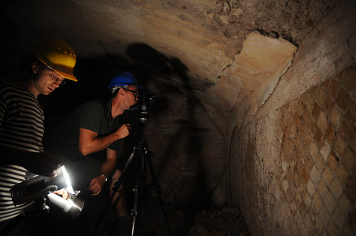
The Portus Project has employed a wide range of digital technologies to assist in the fieldwork, to develop new interpretations and to communicate its findings to a wide audience. The great extent and complexity of the site and surrounding landscape of Portus requires a multi-faceted approach to their study. For example, we use a wide range of methods to explore the archaeology laying both above, and below, the ground. Processes such as photogrammetry, laser scanning and reflectance transformation imaging (RTI) allow researchers to examine, record and present the surface layers of the site and its artefacts in extraordinary detail. Other technologies, such as ground-penetrating radar, sidescan sonar, and magnetometry give archaeologists the capacity to see into the earth and chart future excavations.

Computation has been at the heart of attempts to integrate data and interpretation, and to communicate the complexities of the site to a wide audience. For example, the Portus Project is employing computer graphics for four separate purposes. Firstly, these tools are being used as mechanisms to integrate the diverse spatial data gathered via our research. For example, we are combining three-dimensional geophysics with laser scans and excavated sections to understand the development of the Building 5. Secondly, computer graphics provide a means for developing interpretations of the data. At the corner of the surviving cistern complex (Palazzo Imperiale II) such simulation has helped us to understand how water may have been moved between the harbour buildings. Thirdly, they are being applied towards formal analysis of the site, for instance in terms of structural analysis, studies of lighting, and assessment of the use of space at the port. Finally, still, animated and interactive computer graphics are enabling the project to communicate its interpretations widely. In addition to creating these visuals, we are researching the role that visuals have played and continue to play in the representation of the site.
You can learn more about the Portus Project at www.portusproject.org
