Between the Desert and the Nile. Theban Harbours and Waterscapes

The West Bank of Thebes
Back in 2011 the Theban Harbours and Waterscapes Survey (THaWS) started with a field season of geophysics. This Egypt Exploration Society project (www.ees.ac.uk), directed by Dr Angus Graham, was established with the aim of using different techniques to study the settlements and temples on the east and west banks of the Nile, and how they relate to the changing floodplain and river. Unfortunately the season had to be aborted after the 25th January revolution, and the survey was postponed to the 2012 season, when the fieldwork progressed at a cracking pace.
After five years of the project a large quantity of survey data, together with sedimentary data from auger samples, has been collected and is pushing forward some tentative interpretations about the archaeology and geomorphology of the area. Fieldwork in areas as diverse as Malqata, Birket Habu and the floodplain in front of Kom El Hetan and the Ramesseum has provided food for thought on the depth of ancient ground levels and the organisation of the waterways on the West Bank, with interesting results from some of the East Bank work, including Karnak.
For the 2015 season the fieldwork has shifted up a notch with a larger and more diverse team. The plan was to run different geophysical survey techniques, while also continuing the auger sample strategy and processing of samples from the 2014 and 2015 seasons. Work has very much focused on Electrical Resistivity Tomography (ERT) surveys on the West Bank, particularly in the area to the east of the Ramesseum heading up to the current course of the Nile, with Ginger Emery working on the instrument. This has been complemented by an intensive season of auger work conducted by Ben Pennington and Willem Toonen, to investigate changes in the sediments represented in the ERT.

ERT survey under way on the West Bank

Auger work along ERT profile 32, West Bank
The survey has allowed a solid dataset to be collected running from c.600m to the east of the Ramesseum all the way the the modern banks of the Nile, with the resistivity and auger data integrating to allow some more nuanced interpretations of the development of the floodplain and the presence of possible man-made canals to be ascertained. The work in this area relates closely to the function of temples further to the south between the Birket Habu and the Ramesseum.

ERT profile running at the foot of the Colossi of Memnon, Kom El Hetan
This week we have focused the work in the area of Kom El Hetan. Previous seasons provided information on the axis of theTemple of Amenhotep and the possible presence of channels associated with the temple. The aim this week has been to expand on this information with more intensive ERT and Ground Penetrating Radar (GPR) survey in the area.
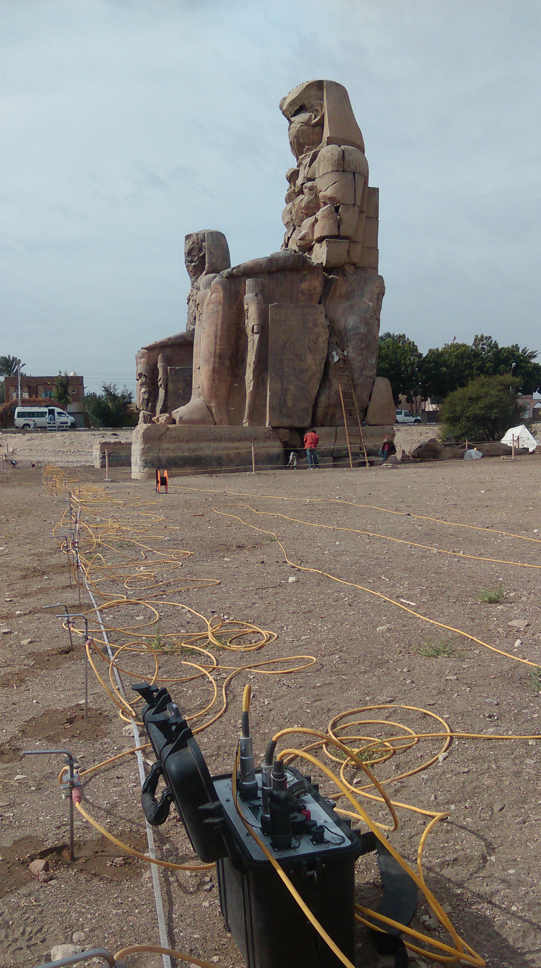
ERT survey at Kom El Hetan
Hopefully by the end of the week we will have a series of close (5m) profiles of ERT data to model, and GPR data at 0.5m intervals across the front of the Colossi, in the first court, and in the third court for comparison, with a second plan to conduct more GPR profiles in the fields to the south to detect the possible enclosure of the temple. It promises to be an exciting week.
There have been trials and tribulations in the fieldwork, including negotiations with landowners, and issues with the burning of sugar cane chaff during the first two weeks. There have also been compensations, not least in the form of tea and cake, the latter being provided by the wife of Sumara, one of our workmen.
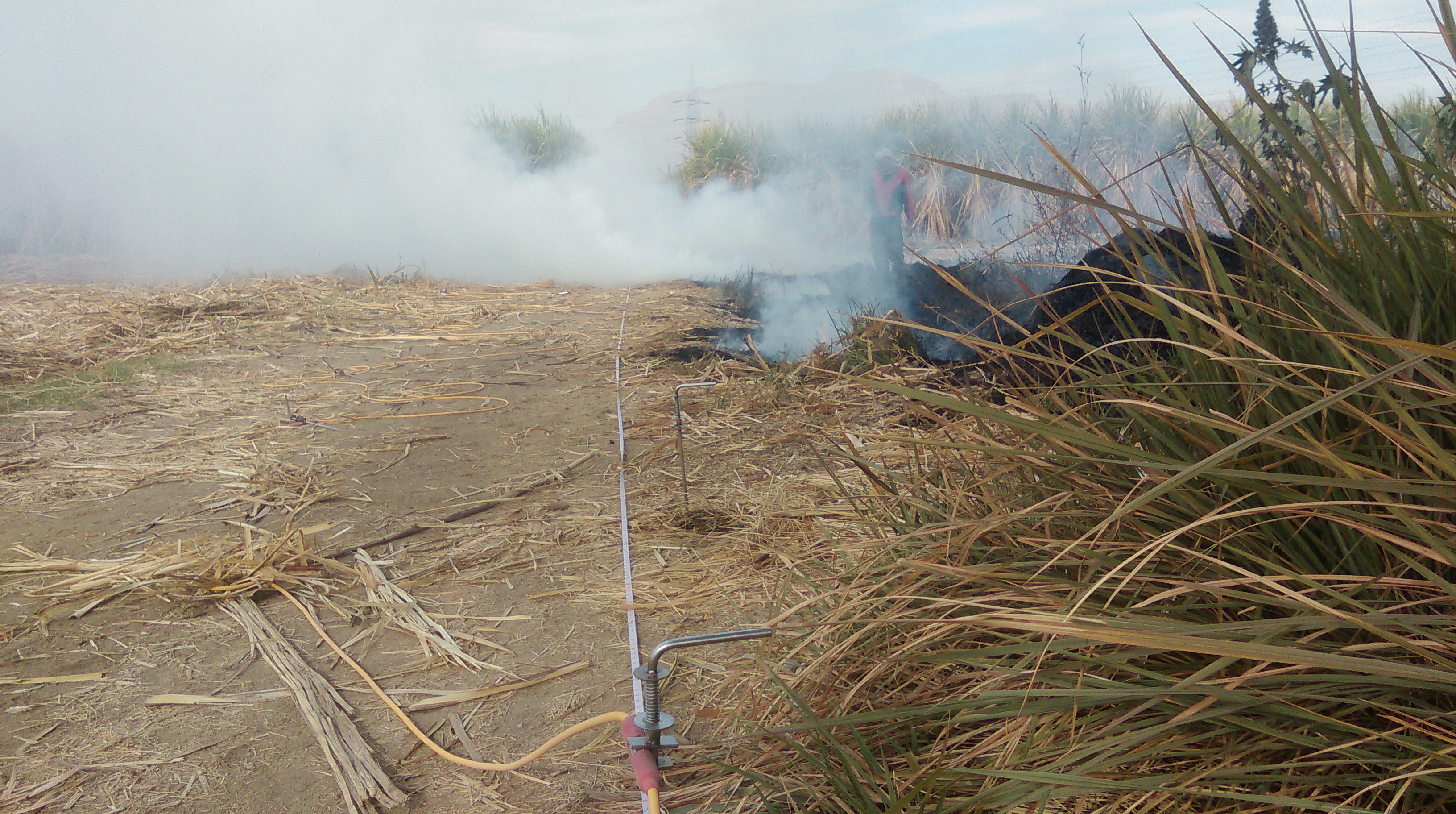
Burning sugar cane chaff promises to engulf the ERT equipment

Husam cuts the cake provided by Sumara’s wife. One of the perks of fieldwork in Egypt!
The fieldwork will be carrying on at Thebes until 1st April. However, results from the previous seasons of work are presented in the last three editions of the Journal of Egyptian Archaeology, and in other papers listed below. Happy reading!
Graham, A. and Strutt, K. 2012, The Theban Harbours and Waterscapes Survey. Recent Fieldwork to Investigate the Canals and Harbours on the West and East Banks at Ancient Thebes (Luxor), Egypt. The Newsletter of the International Society for Archaeological Prospection 31, April 2012, 6-7.
Graham,A., Strutt, K., Hunter, M., Jones, S., Masson, A., Millett, M., Pennington, B. 2012, Reconstructing Landscapes and Waterscapes in Thebes, Egypt. In Journal for Ancient Studies eTopoi, 3, 135-142.
Graham, A., Strutt, K.D., Hunter, M. , Jones, S., Masson, A., Millet, M., and Pennington, B.T. 2012, Theban Harbours and Waterscapes Survey, 2012. Journal of Egyptian Archaeology 98, 27-42.
Graham, A. and Strutt, K. 2013, Ancient Theban Temple and Palace Landscapes. In Egyptian Archaeology 43, Autumn 2013, 5-7.
Graham, A, Strutt, K., Emery, V.L., Jones, S. and Barker, D. 2014, Theban Harbours and Waterscapes Survey, 2013. The Journal of Egyptian Archaeology 99, 35-52.
Graham, A. and Strutt, K. (forthcoming), Ancient Theban Temple and Palace Landscapes. Egyptian Archaeology. Journal of Egyptian Archaeology 100.
