Abu Dhabi Islands Survey Part One
In October a survey team from the University of Southampton were involved in an archaeological and geophysical survey in collaboration with the Maritime Archaeology Stewardship Trust (MAST) and Abu Dhabi Tourism and Culture (ADTCA). Research was carried out on the islands of Sir Bani Yas and Marawah investigating a range of different sites. The ‘Ubaid settlements and archaeology on Marawah will be the subject of the next blog. The Bronze Age and pre-Islamic archaeology of Sir Bani Yas will be covered here.
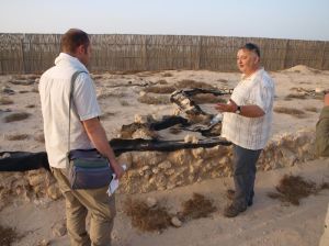
The only way to arrive on Sir Bani Yas is by the ferry normally used for workers and tourists heading to the island. The journey of a few hours takes you to an island some 11km across, used as a nature reserve to attract tourists to the area. As with many of the islands along the coast of the Western Region of Abu Dhabi, archaeological remains on Sir Bani Yas include Neolithic and Bronze Age settlements, and sites of pre-Islamic and Islamic date. The 2014 season of work was used to record archaeological sites across the island using handheld GPS, for comparison with the resords of the Abu Dhabi Islands Survey (ADIAS) database fro mthe 1990s. In addition geophysical survey of two of the main sites was undertaken; at a Bronze Age site close to the island’s airport, and at the Eastern or Nestorian church site on the eastern side of the island.
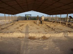
The central area of the Nestorian church site, comprising the church and some possible lodgings, have already been excavated and rendered for 3D modelling, and a video covering the site can be found at http://www.youtube.com/watch?v=GyaTeoCmuLM. The purpose of the geophysical survey was to investigate the possibility of buried structures associated with the church using GPR and magnetometry.
The survey results indicated that the area to the south of the church is devoid of structural remains. However, the areas to the north and north-west give evidence of a continuation of structures, with a possible small courtyard to the west of the entrance to the church. In fact the tooography of the site beyond the modern enclosure suggests the extension of the site northwards, with pottery to the north and the location of a possible courtyard house downslope to the north.
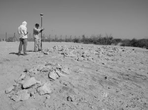
In addition to the Nestorian church, a Bronze Age site was also surveyed using GPR and magnetometry. The site was thought to be a possible tomb, although evidence of bloom or slag on the survey may indicate that it is a working site of some description. Evidence of a possible kerb along one edge is plausible.
GPR and magnetometer survey were carried out over the area. We also conducted some photography for rectification, usig a series of markers and a monopod with DSLR camera. The plan was to produce a topographic model and plan of the visible stones of the site on the surface, and compare these with the results of the geophysical survey.
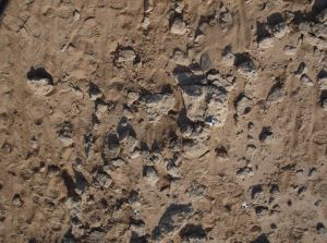
The survey results indicated a sub-circular stone structure, some 6m across, with a further possible working area to the south and west, and gullies or small ditches enclosing the features. We still need to map the results with the plot of stones on the surface to fully understand the nature of the site, however, it is looking more like a possible prehistoric working site, possibly for smelting copper.
The survey results from Sir Bani Yas really illustrated the potential of the archaeology of the island, and the geophysics together with the mapping of the sites suggests some possible outlets for future research. For those interested in the prehistory of the Abu Dhabi islands, however, the work on Marawah provides a wonderful example of the ‘Ubaid Neolithic in this area, more on that in the next blog!


