Blog Catch-up #1: Archaeology and Survey in the Nile Delta at Naukratis
Due to commitments in the field over the last month or so it has proved difficult to keep up to date with the blog. Now seemed like a good time to produce a few posts to highlight some recent fieldwork and site visits, starting with a recent survey at Naukratis. In May 2014 I conducted geophysical survey at this archaeological site in the Nile Delta. The Naukratis fieldwork project is directed by Ross Thomas of the British Museum, and seeks to assess the surviving archaeology of this important ancient site using a range of complementary methods including topographic and geophysical survey, in addition to borehole survey and excavation, as part of a larger project directed by Alexandra Villing of the Greek and Roman department of the British Museum called ‘Naukratis: Greeks in Egypt’.
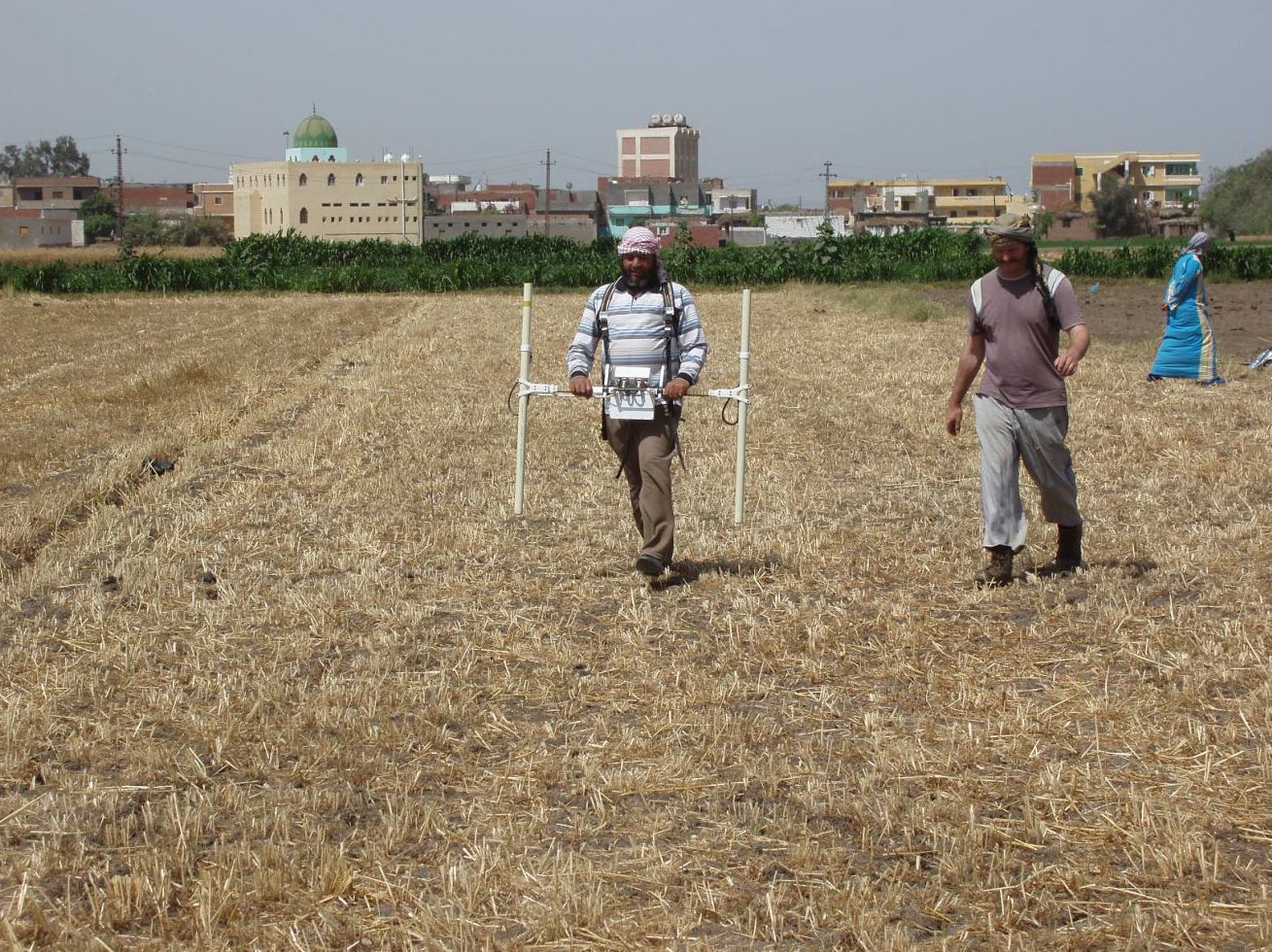
Magnetometer survey being conducted to the east of Kom Ge’if
The season in May (the third season of fieldwork) added to the existing dataset from the first two seasons in 2013, mapping the extent of the ancient settlement and its association with the Canopic Branch of the River Nile.
The port of Naukratis was the earliest Greek port in Egypt, established in the late 7th century BC as a base for Greek (and Cypriot) traders and the port of the royal Pharaonic city of Sais. It was an important hub for trade and cross-cultural exchange long before the foundation of Alexandria and continued to be significant through the subsequent Ptolemaic, Roman and Byzantine periods. Previous fieldwork was conducted by Flinders Petrie amongst others, and concentrated on excavation of the central areas of the ancient town. Further research was required to fully understand this very important archaeological site. For this season, the magnetometer survey of the site was continued in the fields surrounding the modern village.
Two ERT profiles were also undertaken using an Allied Associates Tigre ERT. The first of the profiles ran from a point some 400m to the west of the site, over the kom or mound, to a point 400m to the east of the site, incorporating the line of the Canopic Branch of the Nile and Naukratis. This provided a section 15m deep running west-east across the southern part of the site. The main aim was to better understand the geological relationship between the river and the settlement, and to tie the profile in with the series of borehole surveys conducted along the same traverse.

Mohamed Roshti assisting with the ERT survey on the kom
The survey work at Naukratis has produced significant new data on the layout of the ancient town, its local environment and hinterland, including the location of the Greek sanctuary complex, the Hellenion, and the Temenos or temple enclosure at the site. The magnetometer results located a large number of mud brick and stone structures in the fields around Kom Ge’if, particularly in the north and east of the site. In addition to the plan of the ancient town, the magnetometer results also give us a much better idea of the extent of the ancient site in relation to the location and development of the Canopic branch of the Nile, which ran to the west of the ancient settlement. The magnetometry clearly shows the change from settlement to canal infilling, with structures positioned along the edge of the canal. This data is reinforced by the results of the ERT survey. The depth of deposits underlying and surrounding Kom Ge’if is suggested by the topography, with a sharp contrast between the kom and the surrounding fields. The remains of the ancient site are present, if buried, but life in the modern village of Kom Ge’if carries on. The village, with its new mosque, stands out from the surrounding floodplain, a mixture of bean fields, and brown ploughed and saturated fields prepared for planting melon. A number of venerable sheikhs’ tombs stand out on the fringes of the village. The local shepherd crosses from field to field, allowing his sheep and goats to graze on the stubble remaining from the wheat harvest, and manuring the fields in the process, then herds the flock back through the winding streets of Kom Ge’if.

Detail of survey results from Naukratis
Many of the areas of the ancient settlement still require surveying using magnetometry, and a combined strategy of ERT survey with drilling of boreholes will provide useful comparative data for particular parts of the site and its hinterland.
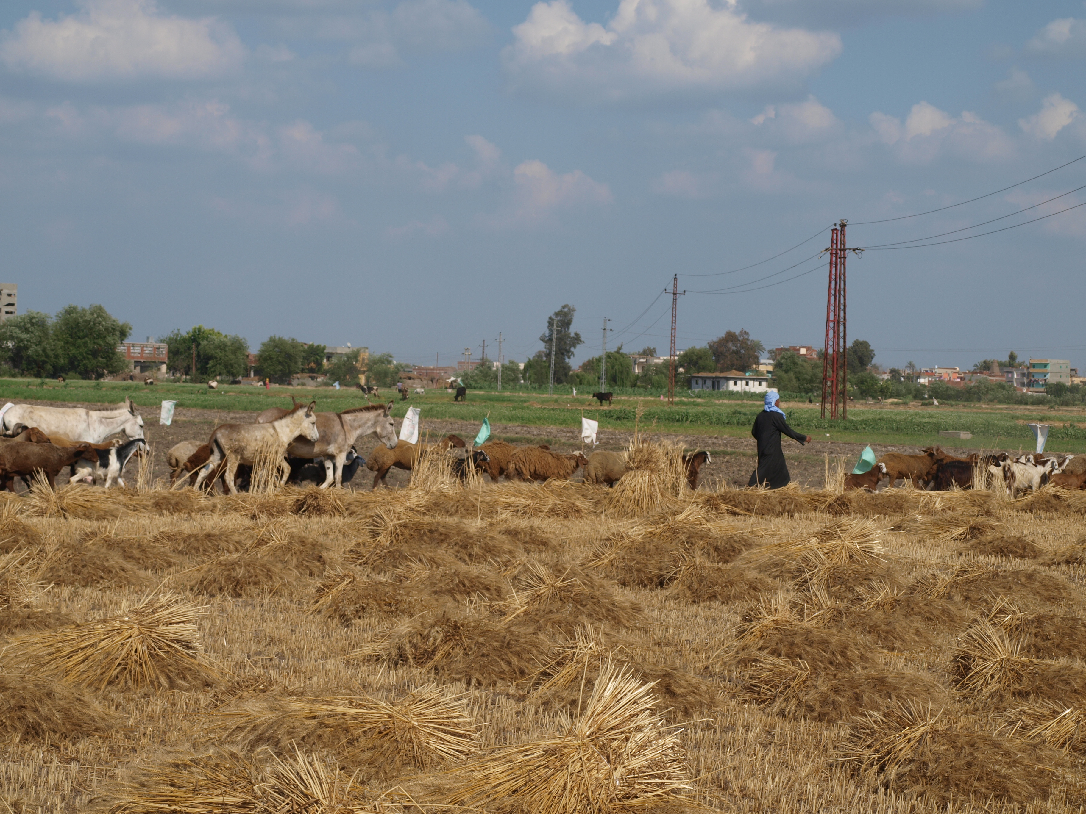
Shepherd leading flock to feed on cut fields
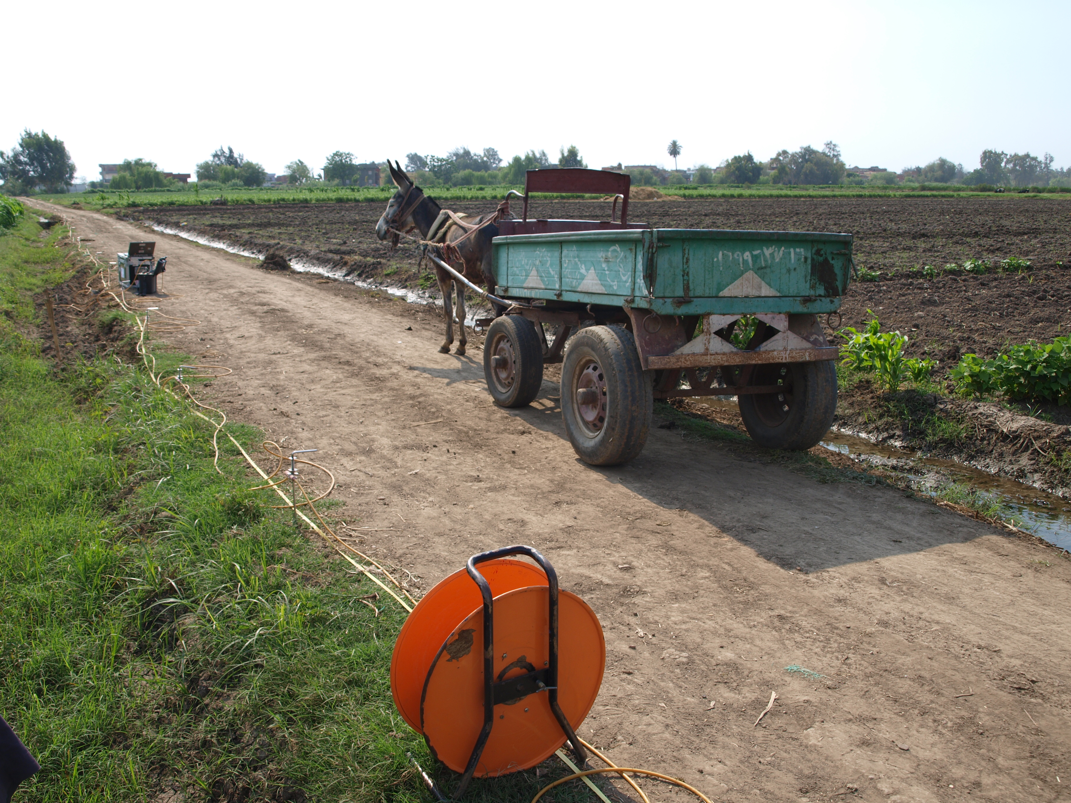
Donkey transport for the ERT
More information on the fieldwork at Naukratis can be found on the project website at: http://www.britishmuseum.org/research/research_projects/all_current_projects/naukratis_the_greeks_in_egypt.aspx
Also, you can discover more about the artefacts recovered from Naukratis by visiting the Online Research Catalogue at:
http://www.britishmuseum.org/research/online_research_catalogues/ng/naukratis_greeks_in_egypt.aspx

Sunset over Kom Ge’if
This post is a reworking of an article recently published in the International Society for Archaeological Prospection (ISAP) Newsletter for May 2014.
