Our 1960s excavation
The excavation this Summer, we’re reinvestigating excavations carried out by Aldermaston Archaeological Society 1962-3 at Basing House.
Reported in the Proceedings of the Hampshire Field Club (Pike & Combley, 1964: 11-20), the excavations consisted of a long trench (c.1m x 30m) which ran from the bank and ditch at the back of the earthworks of the main house at a right angle, towards the Basingstoke Common.
After the long trench was excavated (plus some additional trenches dug into other areas of Basing House), the society returned in 1964 to carry out a magnetometer survey and to extend the long trench as a box grid excavation (Combley, Notman & Pike, 1964). The extended excavation ran between 1964-66.
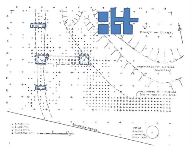
We are lucky that the society, presumably because of their association with the Aldermaston Atomic Weapons Facility, had access to surveying equipment, as this was quite unusual at this point in British archaeology. From the survey data, a suspected ditch system was identified, and sections were cut to test this theory.
This is the plan from the magnetometry survey that the society produced for the Hampshire Field Club publication. The sections cut to check anomalies coming up in the survey are marked out by thick dotted lines:

Magnetometry survey plan, carried out by the Aldermaston Archaeological Society in 1960s. From the Combley, Notman, Pike, 1964 report.
The long trench that had been dug between 1962-3 had yielded Roman pottery, coins (4th century) and tile, and so the society decided to extend their excavation at this end of the trench and laid out a series of box grid trenches. At the top of the magnetometry results plan above, you can see this grid of trenches. This is the area that we are going to be uncovering and re-excavating this season.
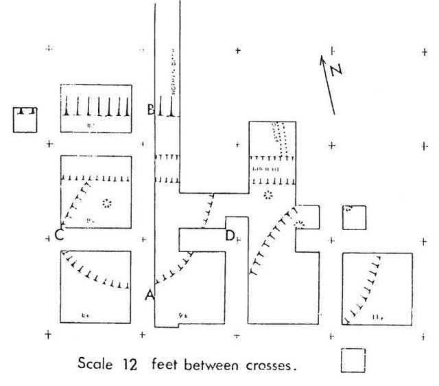
The plan from the 1964 report below shows the grid in detail:
The trench running from south to north and disappearing off from the figure, is the end of the thirty metre long trench from the 1962-3 excavations, the end at which the Roman finds were excavated.
In the next post, we’ll talk about the findings from the 1964-66 excavations, and give an overview of what the team from the University of Southampton and from Hampshire County Council are hoping to clarify…
Reports
Pike, H.H.M., R.C. Combley, 1964. Excavations near Basing House, 1962-63. Proceedings of the Hampshire Field Club, 23(1): 96-109
Combley, R.C., J.W.Notman, H.H.M. Pike, 1964. Further Excavation at Basing House, 1964-66. Proceedings of the Hampshire Field Club, 23(1): 96-109
Filed under: Excavation Plans, Summer Excavation Tagged: aldermaston archaeological survey, box grid, hampshire field club, magnetometry

