End of Theban survey and up to Antinoupolis
The internet connection at Sheikh Ebada near El Minya is terrible, so no blogging for the last week. This is the first time I have managed to get set up so there is plenty to write about. We finished the survey at Thebes on 7th February, and Angus and the team departed for the UK on the 8th. We caught up with some American colleagues before the end, and enjoyed an amazing view of the West Bank including Kom el Hetan, one of the focal points for the THaWS survey.
Stayed in Chicago House on the following nights, and finally met up with Jay Heidel the Director of the Antinoupolis Foundation, and prepared to head up to Sheikh Ebada. We left on 10th February by mini van, a journey time of five and a half hours with the new eastern desert road, as distinct from the seven to nine hour journeys previously.
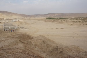
On 11th we did a reconnaissance trip over the site of the ancient city and necropolis. The city covers some 120 hectares, enclosed by a defensive wall (or the remains of the structure) nd the necropolis extends to the north and east of the city, covering a massive area. A modern cemetery is encroaching on the site from the north, overrunning the hippodrome and the city walls.
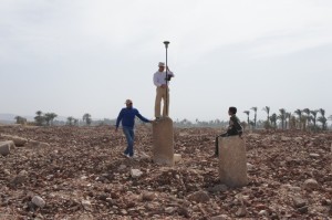
The aim of the survey this year is to use magnetometry in the areas most affected by modern development, in both the necropolis and city. Work started properly on 12th February, when we set up the GPS over one of the local coordinate system points for the project and started gridding parts of the site, and recording stations along the cardomaximus.
We are working with Ahmed of the Quftawi family,an two local workers, Mahmoud and Waleed. Magnetometry started in the necropolis last thursday, and continued on Saturday, with more tombs and other anomalies showing in the results. Will post up more photos and give a better idea of the nature of the site, the surrounding landscape and the sights and sounds of Middle Egypt in the next few days.


