Geophysics at Karnak – Intensive GPR survey and the beginning of the end of the survey
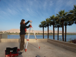
The latest work on the THaWS project has been marked by the intensity of survey profiles and survey areas covered, and the fact that the team have been working almost exclusively in and around Karnak temple. The transition of the GPS survey from the West to the East Bank went smoothly, as reported in the last post. We established a base station on the roof of Chicago House on the West Bank, with the very kind permission of the staff. Some wonderful views were visible across the Nile to the banana plantation and desert edge on the West Bank, andthe set-out made survey convenient for the work at Karnak.
Much of the ERT profile work was supervised this week by Angus and Ginger, with Dom and myself on the GPR with Sarah wielding the GPS. The plan was to expand on last year’s survey and run a series of ERT and GPR profiles in north-south and west-east directions across the temple complex. Work on the GPR was started running from west to east to the north of the Hypostyle Hall, past the Midddle Kingdom Court and out through the east gate of the Nectanebo enclosure, with other profiles following north-south through the Hypostyle Hall, and past the obelisks near the third and fourth pylons.
The instrument was set to 160ns, so approximately 8m depth. The results from near the temple had some attentuation from c. 6.50m, however a number of anomalies showed up at a depth of 6m or greater. In addition to the long profiles, we conducted several area surveys with the GPR, including the Hypostyle Hall, the Forecourt and, today, the area close to the excavations along the waterfront outside of the Tribune.
The work this week also gave the team a good opportunity to see some of the lesser-visited areas within the Nectanebo enclosure. This included the First, Third and Fourth Courts, up to the gate of the 10th Pylon. The end of one profile gave us time to admire the carving on the 10th pylon, cut into granite, and the view south along the processional way to the Mut Precinct.
Two profiles were also surveyed in the vicinity of the Temple of Khonsu in the south-western part of the complex. We finished the week outside of the main enclosure in and around the Montu enclosure, the scene of work with Angus, Sarah and Sally Ann Ashton in 2006 and 2007, and with Angus in 2008. The GPR and ERT profiles ran along the outer side of the Nectanebo enclosure wall to the Gate of Ptah, then east from the Gate to the Le Chevrier drain further east. We also ran the GPR along the old ERT profile to the north of the northern Montu enclosure gate, picking out the Ptolomaic and Roman structures surroundin the Montu enclosure.
It was intriguing to revisit some of these areas from previous seasons of work, and see some of the differences there, including the construction of the SCA wallto the north.
Sadly for the last two days I have been stuck in the office processing GPS, ERT and GPR data, focusing on the Karnak results, and soon to be moving on to the West Bank data. Some interesting anomalies have come out of the data this year, and the opportunity to compare the ERT data with the GPR is useful. Two different techniques collecting data to different depths is certainly useful, if a little more complex. The GPR will provide an interesting counterpoint to the broader brush-strokes of the ERT results in the coming days.


