Kom El Hetan, Thutmoses III and Karnak – from the West to the East Bank
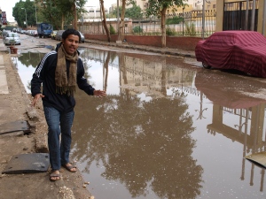
A few days of work have happened since the last blog, and plenty has happened since the weekend. The team woke up on Monday to find that it had been raining all night in Luxor, and it continued until the middle of the morning. So much so in fact that a huge pool of water developed next to the flat entrance. The inadequate drainage meant that around 3pm a van turned up and pumped the water away.
The poor weather, pretty incredible by Luxor standards, prevented any fieldwork that day (everything shut down, and it seemed pointless to survey using ERT and GPR on the West Bank) so a day of office work was planned instead.
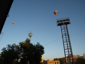
By Tuesday morning the weather had improved, although a strong northerly wind was blowing, pushing that morning’s balloon parties on the West Bank across to South Luxor. The view from the balcony at 6.40am showed them going over the football ground next to the flat, and at least one landed in the fields along the Nile on the road to work.
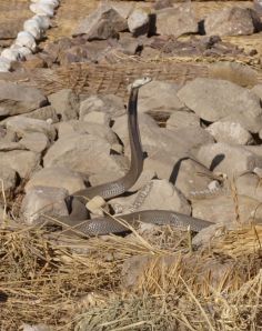
Our work on Tuesday comprised finishing the survey at Kom el Hetan, then running GPR along last year’s ERT profile 4, and conducting some tests of the ERT equipment in the centre of the profile, around one of Wilkinson’s ‘mounds’. The last GPR at Kom el Hetan was covered, and we put a station in for the Colossi team using the GPS. On the way back to the van a disturbance broke out among the workmen on site, and it turned out that a cobra had been disturbed mong the crates and pieces of statue in the third court.
A small crowd gathered, and one of the workmen, speaking to the snake, lured it out of the masonry to the edge of the area, the cobra turning different ways and spitting venom. We had to head back to the van, but the cobra was eventually ‘dispatched’ on site.
We then headed to P4 near the Ramesseum and ran the GPR over the profile, then commenced ERT. The main part of the day’s work was also the GPR and magnetometry to the east of the temple of Thutmoses III to the north. We ran the GPR over the entire area in the end, some 44m by 40m, over 3km of profile. The raw profiles seem to indicate anomalies on the axis of the excavated temple remains to the west.
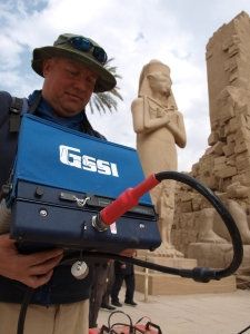
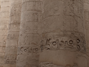
Yesterday saw the team transition to the East Bank and Karnak temple. We set up the GPS base station again on the West Bank at Reis Ali’s house, then used this to establish a new station on the roof of Chicago House on the East Bank. We finished the day surveying with ERT and GPR at Karnak, running the GPR on two profiles across the temple axis, one of these through the hyperstyle hall, with Dom on the GPR console, and Reis Alaa and Yusuf pulling the antenna.
The survey made interesting viewing for the crowds of tourists pcoming iinto the hall by the mid-afternoon. Some anomalies were found along these (over 650m) lengthy profiles, and these will help us to plan the work here in the coming days. More back at Karnak this morning!

