Archaeological Survey at Ras Al Hadd, Oman
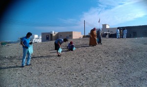
Over the last few weeks a team from the University of Southampton has been working with a team from the British Museum, surveying the archaeological site at Ras Al Hadd. The focus of the survey work was to carry out a topographic survey of the site, and to conduct magnetometer and GPR survey of areas of the occupation mound, prior to the commencement of excavation of the site. In addition the geophysical survey grid was used as the basis for intensive surface collection across the western portion of the site.
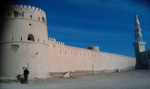
The Bronze Age and Iron Age archaeology at the site forms a mound on the coastal plain a few kilometres from the tip of the south-east limits of the Arabian Peninsula. Later settlement has covered most of the site, including a substantial fort and new mosque. The remnants of post-medieval defence overlie the mounds of the later prehistoric settlement, one of a number in the area of the coast. It is the later archaeology that is immediately striking upon visiting Ras Al Hadd. A number of old cannon litter the village, some propped on breeze block plinths, some lying forgotten. Others are located in the fort, and lines of Martini-Henry rifles line the walls of the entrance to the courtyard. In the vicinity of the inlet and lagoon to the west of the site, a solitary tower guards the entrance to the inlet and the reaches of the lagoon.
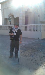
The focus of the survey was, however, the prehistoric material at Hadd. The survey utilised a number of techniques to map the area. The survey grid was established using RTK GPS, with the instrument also being used to map the topography across the site and the surrounding coastal plain between the mound and lagoon. Surface features were also surveyed in for comparison with the geophysical survey results.
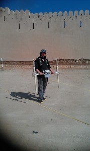
The site was also surveyed using magnetometry and GPR, focusing on the western and northern parts of the mound,where modern occupation has affected the archaeology the least, and within the interior of the fort. Results of the survey revealed a number of potential archaeological features, including remains of earlier phases of the fort, Iron Age pits, and cairns. In addition to the geophysics, the British Museum team and a team of workmen undertook a systematic surface collection of a part of the surveyed area. The preliminary results show the strength of the methodology incorporating such techniques, with the plot of the fieldwalking overlying on the geophysics, and giving some clear pointers as to the nature of the ancient deposits.
One of the outcomes of travelling in the area was the opportunity to take a cursory look at the coastal area with a radius of a few kilometres from Hadd. The terrain shows the same plain, covered with thorn scrub and coastal inlets, but with a number of small occupation mounds breaking the topography. Indicating quite a dispersed settlement and use of different sites by the population, from prehistory up until more recent times. An amazing landscapewith hopefully much further scope for work.

