LiDAR Data
This learning object explores the nature of LiDAR data, their characteristics and some common data formats.
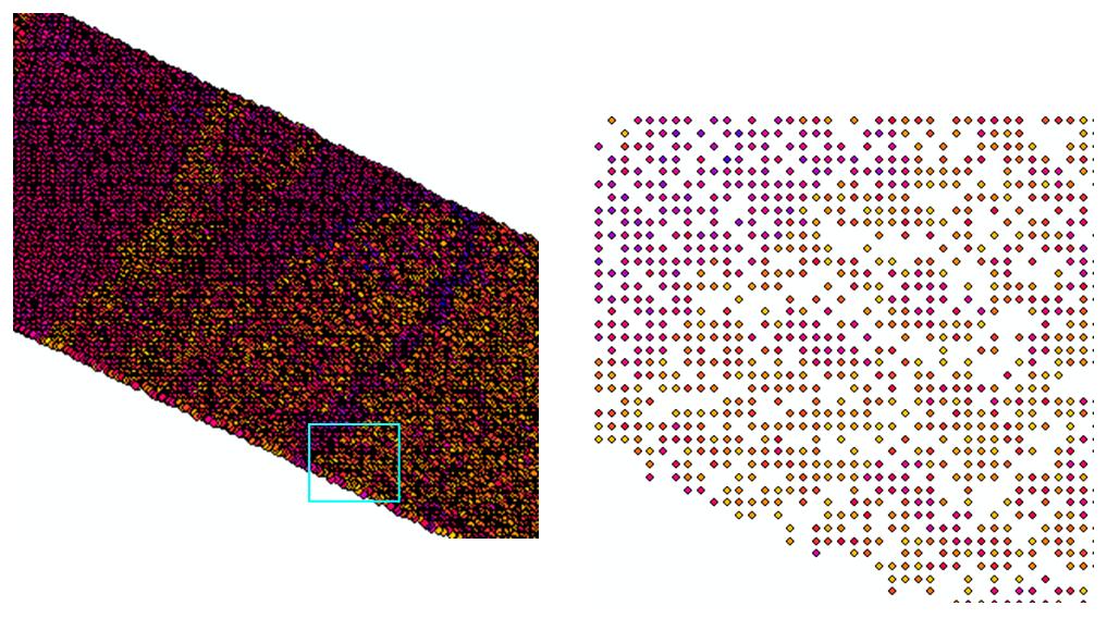
Unlike conventional two dimensional image or three dimensional gridded elevation data, LiDAR data are not organised on a uniformly spaced grid due to the nature of the scanning mechanism. This format of LiDAR data is often referred to as a ‘point cloud’ since they represent clouds rather than objects with fixed boundaries. The figure below shows an example of point spacing in LiDAR data.
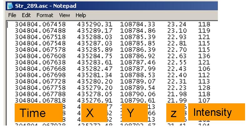
LiDAR data are commonly available as binary or ASCII (American Standard Code for Information Exchange) files. Binary files take less storage space, but are difficult to read without compatible information. Therefore, most of the commercial suppliers deliver LiDAR data in ASCII format. In this format the data are written out as a text and can be easily read and edited by simple text editors such as Notepad or Wordpad. For each return the file has the following information: (i) time of the day, (ii) x- position, (iii) y-position, (iv) z position and (v) intensity. An example an ASCII LiDAR return is given in the figure below. If a LiDAR sensor records multiple returns then either they are recorded in the same file with information in XYZ and intensity for each return or recorded in separate ASCII files for each return.
Although simple to handle, storage of ASCII format data is inefficient, because they take a lot of space compared to the binary format and we cannot perform any numerical computations on data of this type. Therefore, data in ASCII should be transformed into a numerical format before doing any processing.
In early 2000 commercial suppliers were proving LiDAR data in their own proprietary formats and it was hard to compare LiDAR data from different suppliers. Therefore, the American Society of Photogrammetry and Remote Sensing (ASPRS) set up a committee to define a common format for LiDAR data and this committee recommended LAS format http://www.asprs.org/a/society/committees/lidar/lidar_format.html. LAS is currently supported by all commercial data providers and software developers, thus enabling easy interchange of data from different sources. Some general information regarding airborne LiDAR data is summarised in the table below.
| Data Acquisition | There are a range of private companies, academic institutions, and government agencies that produce and provide LiDAR data. |
| Timing | There are a number of time constraints associated with LiDAR collection and delivery:
|
| Costs | Cost can vary depending on size of project, horizontal postings (point density), and project location. Cost may also increase based on additional product requests (i.e., DEMs, DTMs, contours, etc.), specific accuracy requirements, or licensing restrictions.Most current estimates: approximately £100 per km2 |
| Formats | Common LiDAR Data Exchange Format – LAS Industry Initiative (ASPRS). This binary file format is an alternative to proprietary systems or a generic ASCII file interchange system used by many companies. Things to do while ordering:
|
| Projections | LiDAR data can be delivered in many different projections and datums. |
| Licensing | Licensing restrictions vary for each LiDAR service provider. Many providers do not have restrictions on their data products, but some companies do require licensing. |
Activity
Please read the PDF copy of LAS format and familiarise yourself with this data format. (A copy is included in the reading material folder on the Blackboard site for this module).