Introduction to Photogrammetry
This learning object introduces photogrammetry. It contains a brief introduction to photogrammetry, aerial images and related information on their use in land surveying.
What is Photogrammetry?
Photogrammetry = Photo + Grammetry = Photo + Measurement
It is both an art and science of obtaining quantitative information about a geographic phenomenon or objects using photograph(s) from calibrated cameras. Calibrated cameras refers to cameras whose behaviour is known in terms of characteristics such as focal length and modulation transfer function (MTF) (which determines the spatial resolution of the camera).
Reflection
Below is an example of an aerial image. Examine the image for 20-30 seconds. The image may trigger some natural thoughts and you are likely to find yourself automatically interpreting the image, based on experience of having seen similar images before. Consider how you would answer the following questions and then click on the button below for some hints and feedback.
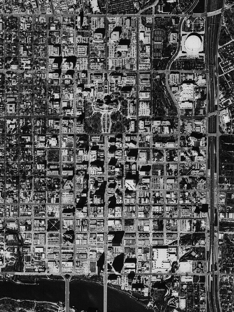
1. Name five different types of feature you can identify in the image (for example: buildings)
2. Is it possible to estimate the height of a building? If yes, then how? If not, then why?
3. How would you estimate a distance between two points on the image?
Question 1: The features could be any objects or characteristics of the image. For example, you may have noticed streams/rivers, bridges, tall buildings, parks, roads.
Question 2: We can use the shadow as a clue to estimating the height of a building. To do this with any degree of accuracy we would need to know the position and angle of the sun. Can you think of any other ways?
Question 3: In order to find the distance between two points we need to know the scale of the image/photo. Could you estimate the scale of the photo? You may be able to do this by measuring the width of a road on the photo and then comparing this with a typical road width. The ratio of the distance in the photo to distance on the ground would provide an estimate of scale. From a knowledge of the scale we can measure any distance or length.
Incorrect
Types of aerial photographs
A few different regions of the electromagnetic (EM) spectrum (visible lights, infrared and thermal) can be used to capture aerial images. These images can be categorised into two broad types: vertical and oblique. Vertical photographs, taken vertically from above, can have a maximum tilt of up to 3 degrees. Oblique photographs may be at low or high level. In low oblique, the horizon would be invisible, but it will be visible in high oblique photos. Photographs taken at ground level will be called terrestrial photographs.
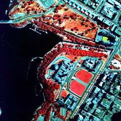
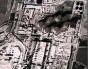
a) The following images show aerial photos taken in visible, infrared and thermal regions of the EM spectrum.
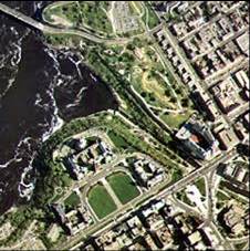
b) From the description above, are you able to recognise these different levels of oblique photographs?
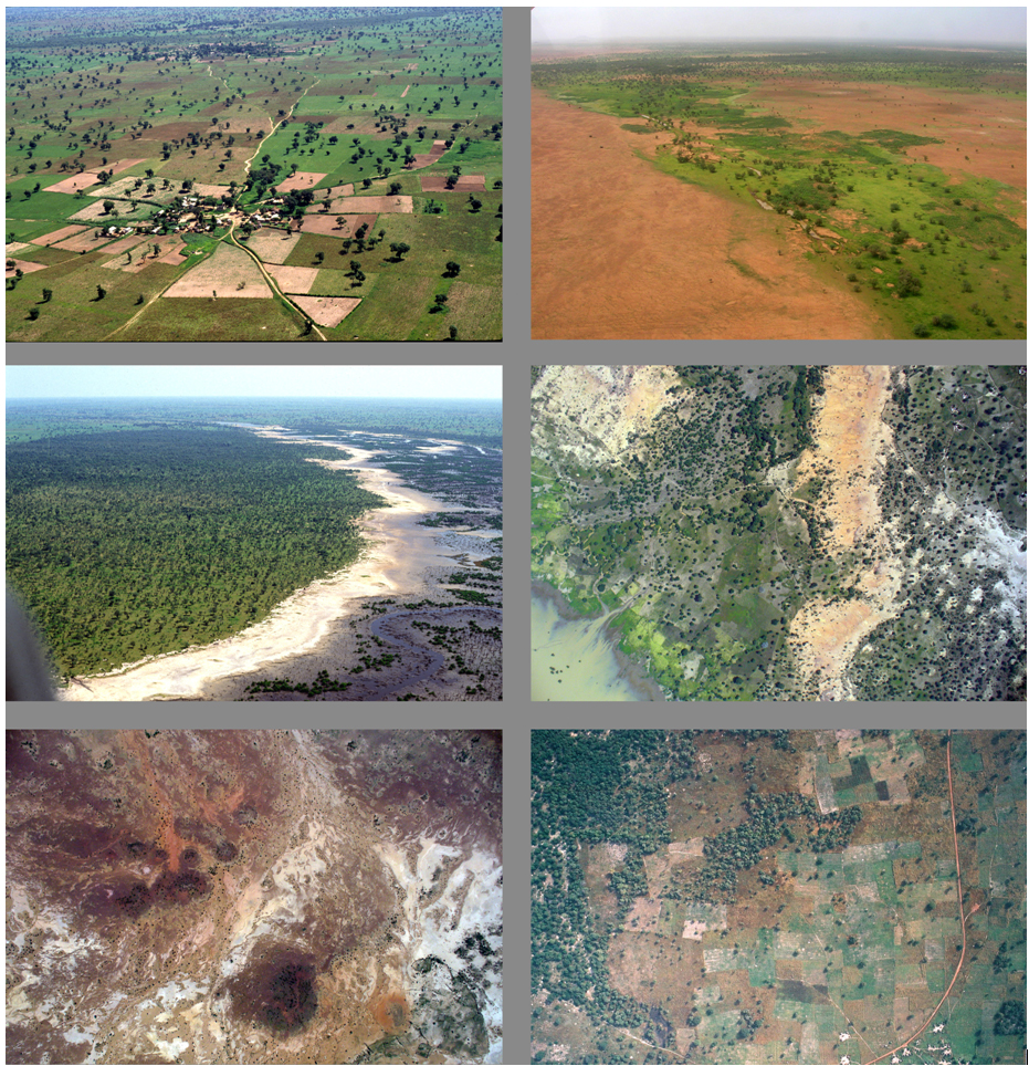
(Source: USGS Land cover Applications and Global Change)
Reflection
Drawing on your remote sensing knowledge, you may be familiar with the spectral characteristics of various land cover features. Attempt to give a brief description of the different colours and features in the images at (a) above. What is indicated by the white colour in the final image?
In the images at (b) above, how many are taken vertically, at low oblique and high oblique angles?
In the visible region, the green colour features represent vegetation because of their high reflectance in the green band due to chlorophyll in the leaves. The red colour in the infrared image also represents vegetation because of its very high reflectance in the IR region. In the thermal image the white colour represents hotter areas and dark tones represent cooler features.
Incorrect
Surveying and photogrammetry
Photogrammetry has provided tremendous advantages to land survey-related planimetric applications.
Compared to land survey, photogrammetry based survey has the added advantages of being:
- Cost effective
- Faster
- Comprehensive (i.e. capturing all topographic variation in detail)
However, it is important to realise that photogrammetry still needs help from land-based survey:
- To fix ground control points (for benchmarking in height or x,y)
- To investigate/map features which were not explicitly visible in aerial images (for example, in shadow regions or inside dense forest regions)
The following video provides a glimpse of the use of aerial photographs in land survey and advances in related computer processing.