Aerial Photo Interpretation
This learning object deals with the interpretation aspects of photogrammetry. The reader is expected to learn about various elements of aerial image/photo interpretation, and to gain an understanding of their importance.
Image Interpretation
Image interpretation is the act of investigating images/photos in order to extract useful information about the features in the image. Experienced interpreters use as many as eight major interpretation elements:
- Shape
- Size
- Pattern
- Texture
- Shadow
- Association
- Tone/Colour
- Location
However, beginners may not be able to use/identify all of these elements consciously. The following section briefly touches upon each of these elements.
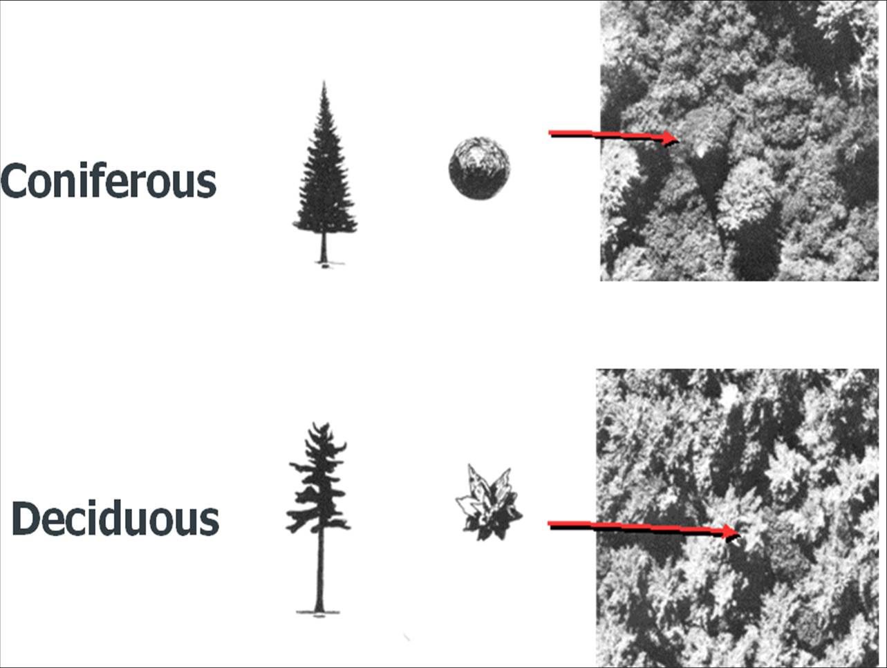
Shape
Almost all geographical features have certain key distinctive characteristics. Man-made features have clearly definable shapes (e.g. square, rectangle, circle, triangle, etc.) which is in contrast to natural features which have complex shapes. For example, in a tree, branches and leaves have characteristic shapes which can be categorised as below:
Branches may be
- Irregular
- Fine symmetrical
- Coarse symmetrical
Leaves may be
- Crown
- Star
- Regular
- Irregular
The different combinations of these characteristics will allow the experienced interpreter to identify different species of tree.
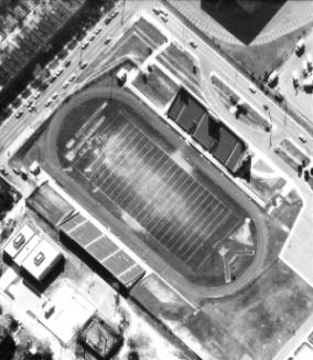
Size
The human eye is very sensitive to the size of an object, as it is easy to detect larger objects. Length, width and area are the parameters measurable (qualitatively as well as quantitatively) under this element. The apparent size of objects will vary with focal length and flying height – thus the scale of the image. The sizes of commonly known objects such as cars, runways, football grounds and other sports fields can help the interpeter to know the scale of the image.
Pattern
Pattern refer to the spatial arrangement of features/objects. Certain recognisable patterns are associated with specific kinds of objects. In the following image, a golf course is quite easy to idenitify because of the presence of its characteristic pattern of objects: grassy areas, tee-boxes, fairways, bunkers, some localised thick vegetation and holes (the latter too small to be seen at this scale).
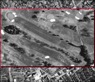
In broad terms the pattern may be either random or systematic. Systematic patterns may be circular, oval, linear or rectangular, etc.
Texture
Texture is easily confused with pattern. Texture is related to the arrangement of tones or colours (i.e. roughness), but pattern is related to the arrangement of objects. In the following image, the bare field and the cropped field can be easily differentiated due to the difference in texture.
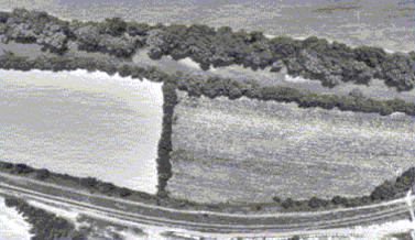
Texture is a function of the distinguishing ability of the camera (i.e. Modular Transfer Function MTF) and also depends on scale. Textures may be categorised as smooth or rough, sometimes with intermediate classes.
Shadow
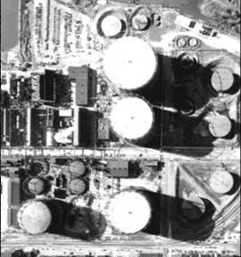
Shadow plays an important role in understanding the height of objects such as buildings. Too much shadow is unhelpful as it may obscure important objects and hence the time of acquisition of the image is very important. It is normally advised to take the picture within two hours of noon so as to avoid long shadows. In the following picture there are many shadow regions clearly depicting the height variation in those objects which otherwise would make it difficult to differentiate their height.
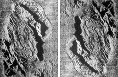
Shadow also helps to enhance the topographic/terrain features. In the following images the shadow depicts the terrain in two different ways. In one it enhances the terrain variation, and in the other it gives a completely different impression which is called pseudo-height in which low points appear as high and vice versa.
Association
There is a natural inter-linkage between various geographic features (man-made as well as natural) and their neighbours. Man-made features have stronger associations, for example ian ndustrial area will have building structures of a particular type, parking lots, waste dump areas, etc. Similarly, a large shopping mall will be associated with a huge parking lot, an airport is associated with runways, hanger areas, towers etc.
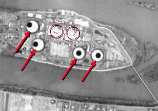
In the following picture, a nuclear plant has clearly associated cooling tanks (shown by arrow marks), and main domes (circled).
Tone and Colour
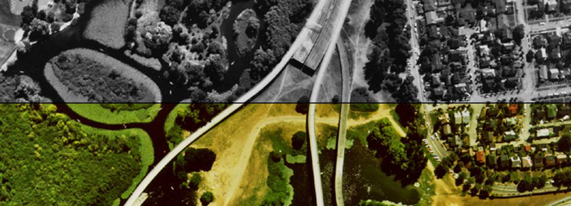
Colour refers to a visible distinguishable property in a spectral sense, and tone refers to shades within a colour. In a black and white image, the tone refers to different grey colours (ranging from black to white). In a colour image, tone refers to lightness or darkness within a colour. The following image depicts a tone and colour variation.
Location
Generally, natural features have a characteristic link to their geographic location. For example, coniferous vegetation usually occurs extensively only at higher altitudes or latitudes. Hence, the occurrence of conifers gives a direct hint about their location (also some fruits/orchards occur in a hilly regions). However, absolute information about location cannot be derived from features. Location can be established either through land survey or through reference to toposheets or using GPS. Knowledge of location makes the interpretation much easier.