Waveform LiDAR Data in Forestry
In this section we will learn about some waveform LiDAR and their application in Forestry.
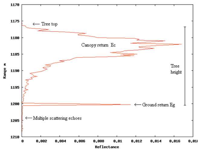
We can measure total energy in the Waveform LiDAR and different time intervals. Energy from the canopy is a function of effective canopy reflectance and fraction of canopy cover, whereas the energy from ground is a function of effective ground reflectance and (1-fraction of canopy cover).
Two parameters can be measured:
- Tree height is the distance between signal start above noise and ground position in the absence of any surface slope
- Canopy cover can be calculated from the ratio of energy returned from the canopy and the ground
For both these parameters the ground and canopy returns must be distinguishable or in other words, the data should have high signal to noise ratio.
There are a number of new waveform systems available, but the most long-established is the SLICER instrument developed by NASA in the 1990s. SLICER (Scanning Lidar Imager of Canopies by Echo Recovery) is mounted on an aircraft platform and scans a swath of five 10m diameter footprints. The waveform has 11cm vertical sampling (0.742 ns) and can be flown at relatively high altitudes.
http://denali.gsfc.nasa.gov/sla/slicer/slicer.html
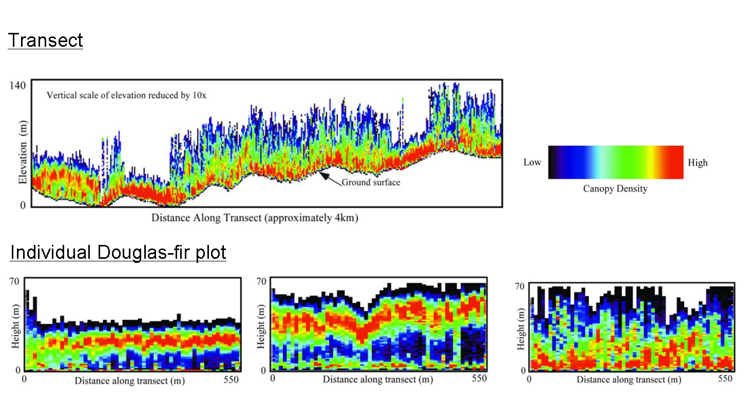
The figure below shows measurements of canopy structure made using SLICER instrument. Top panel shows ground topography and the vertical distribution of canopy material along 4km transect in the H.J. Andrew Experimental forest, Oregon, USA. Each column is the width of one laser pulse waveform. The bottom panel shows close-up of canopies of three 550-m transects in young, mature and old growth Douglas Fir with normalised ground elevation (Lefsky et al., 2002).