Overview
In this section we will learn about the background of use of LiDAR data in forestry.
Background
Forestry is one of the more developed and well established applications of LiDAR data. The ability of LiDAR pulse to penetrate canopy cover makes it quite attractive for generating DEM of the forested areas. Few earlier studies of forestry application include the determination of terrain elevation. Stand wise mean height and volume estimation and tree species classification. These forest structure information is required to support a variety of resource management activities including: timber inventory and management; habitat monitoring; watershed management; fire behaviour modelling.
Compared to traditional forest inventory survey LiDAR is cheaper ( ~£1 per Acre), provides complete coverage with high spatial resolution (<1m). With advance in data generation and processing techniques such as high pulse rate and precision in measurement, ability to have multiple pulse many national forestry agency such as those in Canada, Finland, Norway and Sweden are using this technique as regular basis.
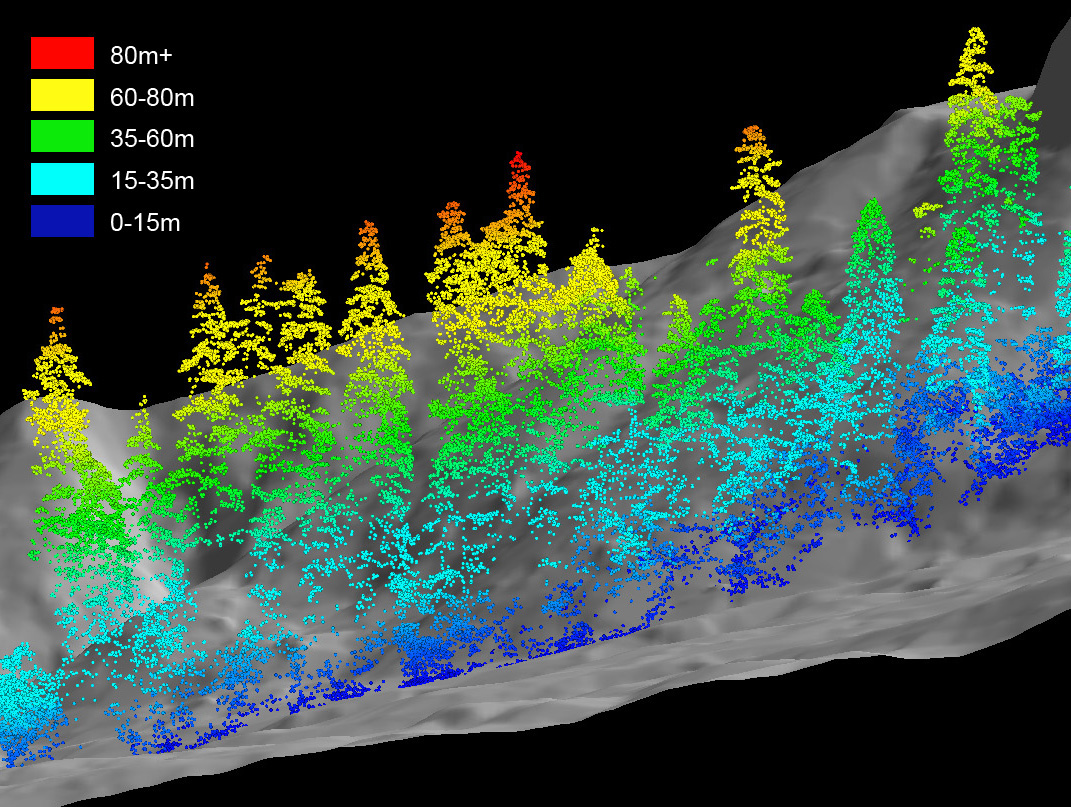
This LiDAR image shows a canopy height profile across a narrow transect through a 500-year-old-growth Douglas fir forest. Each dot represents a return of a laser pulse. The colours indicate height in meters above the ground. This structural variability creates a wide range of habitats for different wildlife and plant species. (Image courtesy of Tom Spies and Keith Olsen, Oregon State University College of Forestry)
Reflection
The figure below shows LIDAR points for two different vegetation types and different growth stages in different colours. Can you first identify the vegetation types and then the colour of LIDAR point related to growth stage?
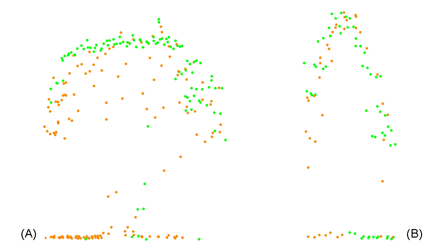
The figure above shows cross section of LIDAR data through a single deciduous tree (A) and coniferous tree (B) including ground returns. The green dots represent leaf-on returns and the brown dots represent leaf-off returns. Note that: for deciduous trees there is a higher difference between these points compared to coniferous tree.
Incorrect
What can be measured?
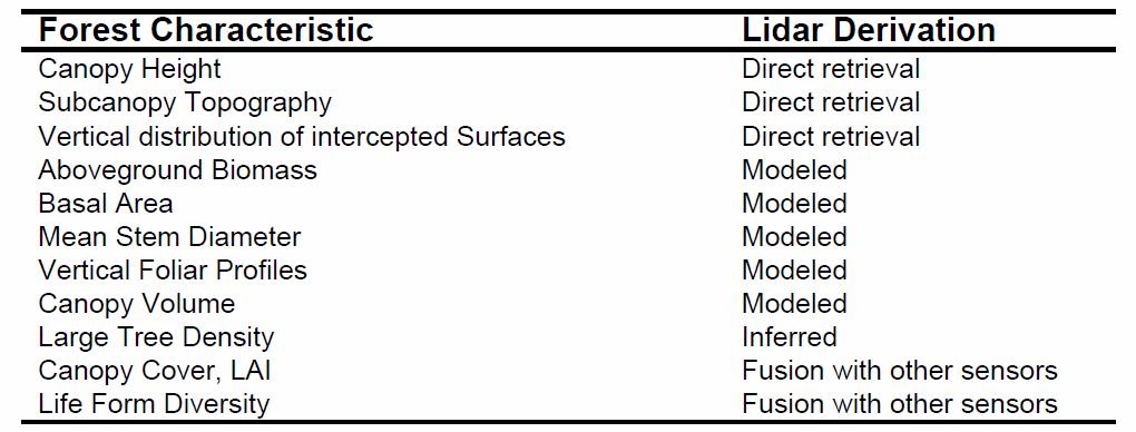
Forest can be characterised by the attributes of a single or a group of tress. Basic attributes for a tree includes canopy height, diameter at breast height (dbh), crown diameter, basal area ( cross section at dbh), volume, biomass and leaf area Index. These are summarised in table below (Dubayah and Drake, 2000). Some of these can be directly measured from the LiDAR data where as others need to be estimated through statistics or modelling. These information are being increasingly used by the United states forest service in assessing forest fire fuel and habitat.
Identifying areas where fuel has accumulated and is creating a potential for catastrophic forest fires is a priority within all national forests. Fuel maps are produced by expensive ground survey or use of optical remote sensing data. But in most cases they fail to provide information on understorey vegetation, one of the essential component for accurate fuel mapping. On the other hand, LiDAR provides the opportunity to map understorey (from multiple return data) and provides key input for precise prediction of spread and intensity of fire.
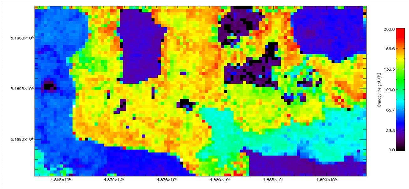
LiDAR derived canopy height image