Spaceborne LiDAR
In this section we will learn about the Geoscience Laser Altimeter System (GLAS), the only satellite LiDAR system launched, to date.
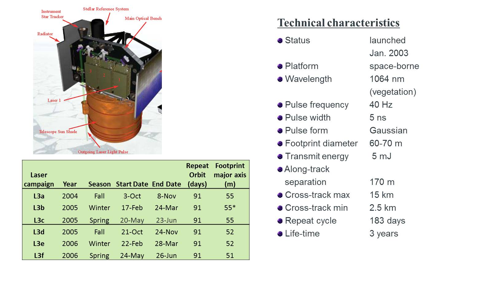
The Geoscience Laser Altimeter System (GLAS) is a new generation spaceborne LiDAR onboard the Ice, Cloud and land Elevation Satellite (ICESat) mission, which was launched on January 13, 2003. GLAS is the first spaceborne instrument which can digitize the backscattered waveform. Moreover, it is the first polar-orbiting satellite sensor which combines high precision surface LiDAR with a sensitive dual wavelength cloud and aerosol LiDAR – a characteristic which distinguishes it from other altimeters. Orbiting at about 600 km, GLAS offers global coverage by carrying three lasers (Laser 1, 2 and 3) with only one operational at a time.
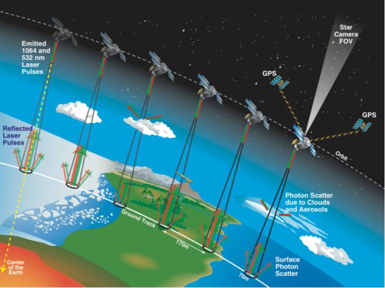
Originally, ICESat was launched to monitor polar ice-sheet dynamics and its role in changing the global sea-level. However, other scientific objectives of this mission also include surface reflectivity, precise measurement of land topography, ocean surface elevations and vegetation canopy heights. GLAS transmits short pulses (4 ns width equivalent to 60 cm in surface elevation) of infrared (1064 nm) and visible green (532 nm) light at a rate of 40 shots a second (40 Hz). GLAS documentation assumes that the transmitted pulse is almost a Gaussian form and so this will be the shape of returned waveform. The reflected photons are collected by a telescope of 1 meter diameter and binned each nanosecond. Each of the 40 shots is telemetered in 544 bins over ice-sheet and land, corresponding to a height of 81.6 m . In steeply sloped areas and/or areas where feature heights exceed 81.6 m, GLAS waveform would truncate, making it inconvenient to derive range information. For this reason, in later operations height extent was increased to 150 m (1000 bins) over land, using a ‘waveform compression scheme’.
The nominal diameter of a GLAS footprint is 70 m (spaced at 172 m on along the track); however, its size and ellipticity have varied through the course of mission. It is equally important to note that footprints of laser 3, laser 2 and laser 1 are moderately elliptical, very elliptical and very elliptical with a side-lobe, respectively. Varying footprint sizes and ellipticity make delineation of the incident area a challenging task and also introduce uncertainties in estimates.
Reading Activity
Read about further details on the GLAS system by visiting the following website:
http://www.nasa.gov/mission_pages/icesat/index.html
GLAS data can be obtained from NSIDC, USA: