Introduction to Optical Measurements
This section aims to introduce different types of 3D optical measurements and to provide a brief history, highlighting the advantages of Lidar systems.
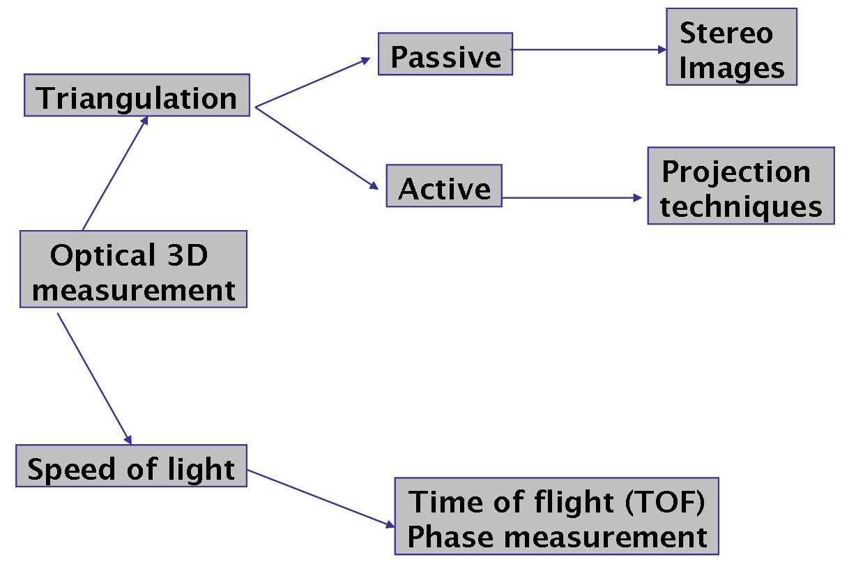
For obtaining elevation data, either the optical (visible to near infra red) or microwave part of the electromagnetic spectrum is used. We will here focus on optical 3D measurements. These can be broadly classified into two principal types of measurement, as illustrated in the figure below. The first is based on triangulation and the other on the speed of light.
Measurements based on triangulation can be passive or active: in a passive measurement technique we use a naturally occurring source of energy to obtain data, for example when obtaining stereo images from airborne or satellite platforms. By contrast, for measurement based on active triangulation we use a source of light or radiation and detect its reflection.
Measurements based on the speed of light can work on two methods: one based on time of flight (TOF) and the other based on phase difference between the transmitted and the received signal.
Activity
Based on your previous learning, or by researching the topic again now, identify the wavelength range of the following parts of the electromagnetic spectrum. You can check your answers by clicking below.
a) Blue
b) Near infra red (NIR)
c) Microwave
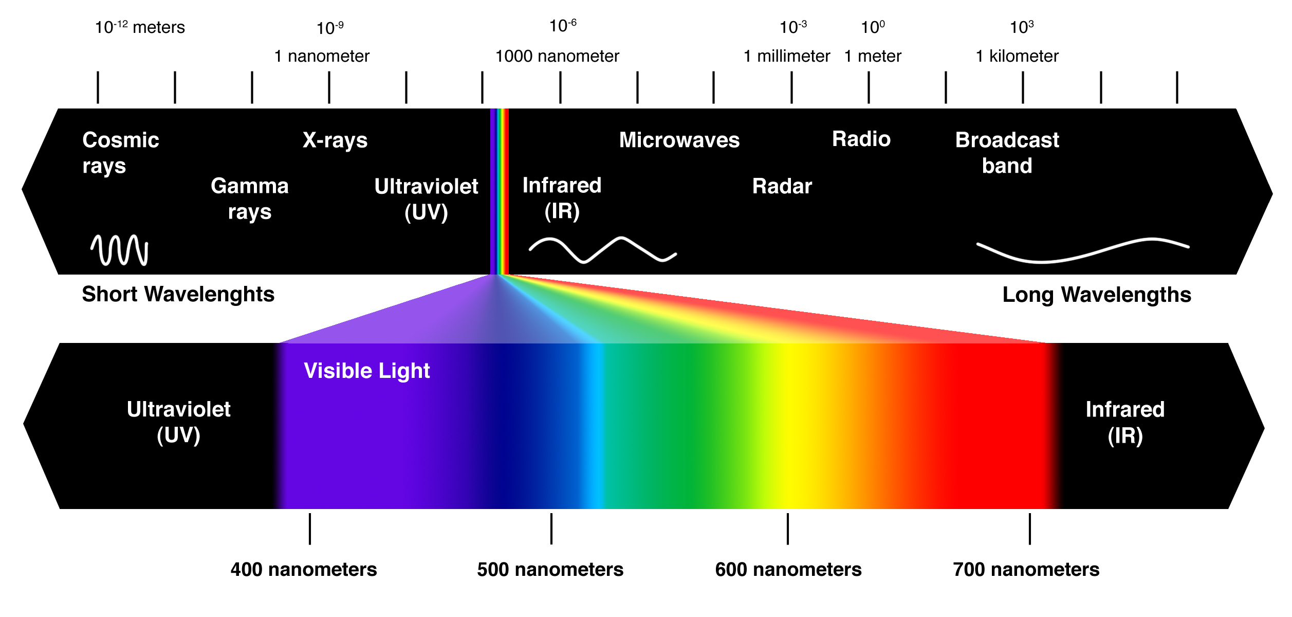
The blue range covers wavelengths of around 450-475 nanometres.
The NIR range has wavelengths of around 0.78-3 micrometers (adjacent to visible light).
Microwaves have wavelengths in the range 187-10 millimetres.
Incorrect
Until the 1990s with the development of airborne laser scanning mechanisms, we were limited to collecting data over a small area and could generally only collect data in one strip. The integration of GPS and laser scanning mechanisms on airborne platforms enabled georeferenced topographic data collection covering large areas, encouraging the adoption of airborne laser scanning. LiDAR (Light Detection and Ranging) has several advantages over traditional photogrammetry in terms of obtaining 3D topographic data. It can be georeferenced enabling the integration of topographic data with other spatial data and it is highly accurate, offering sub-cm/sub-mm laser ranging accuracy.
Compared to other traditional elevation data collection techniques, LiDAR has the following advantages:
- Day or night operation, because it uses its own source of energy
- Efficient acquisition of millions of elevation points per hour
- Faster coordinate acquisition than traditional methods
- All digital: no intermediate steps to generate digital XYZ
- Rapid turnaround: Capable of “overnight” processing
- Captures multiple returns per pulse with intensity information
- Accurate: Elevation +/- 10 cm (or better)
- Airborne: Easy to mobilize and demobilize
- Non-Intrusive method of survey (airborne) capable of accessing remote areas