Recent Comments
Archives
Categories
- No categories
Meta
1.2 What is Remote Sensing?
Perhaps the simplest analogy for remote sensing is human vision: an observer looks at an object. Light reflected or emitted from the object is observed using a sensor (their eyes) and is subject to processing (by their brain) in order to convert the pattern of light into recognition of the object being observed.
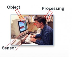
Curran (1985) offers a more exact definition for the purposes of remote sensing which describes this process: ‘The use of electromagnetic radiation sensors to record images of the environment, which can be interpreted to yield useful information’.
The origins of remote sensing can be traced back to the beginnings of photography, generally dated to 1839 (e.g. by Campbell, 2002). The concept of ‘remote’ sensing implies a distant separation between the observer and the object being observed and the 1850s saw the beginnings of aerial photography from balloons.
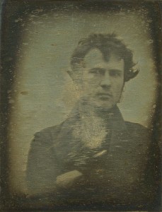
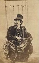
Left: Robert Cornelius: reputed to be the first photographic portrait of a human ever produced, 1939. Right: Felix Nadar, an early photographer and balloonist photographed the village of Petit Bicetre in France from the air. (Image source: Wikimedia Commons, public domain)
James Wallace Black was another balloonist photographer who in 1860 took this view of Boston from a tethered balloon.
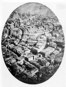
(Image source: Wikimedia Commons: public domain)
Experiments were also undertaken to use pigeons as platforms for photographs.
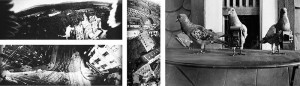
Top left: Aerial photographs of Schlosshotel Kronberg and bottom left and center, Frankfurt; Right: pigeons fitted with cameras (Image source: Wikimedia Commons: public domain)
The First World War was to prove a major impetus to the development of aerial photography, employing the newly invented aeroplane as a platform for the photographer in order to gain reconnaissance information about ground troop movements behind enemy lines. After the war the technology was in place to begin large scale aerial surveys.
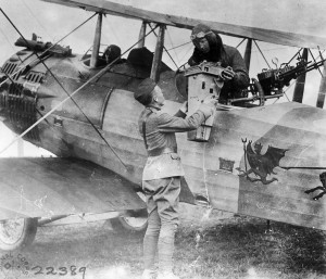
An officer receives a camera and its photographic prize to be processed in the field and its pieces assembled painstakingly, by hand (Image source: Central Intelligence Agency: public domain)
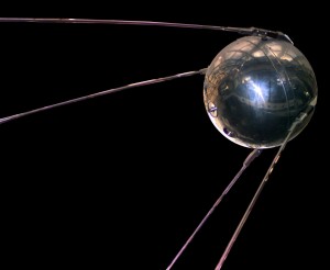
An enormously important change came on 4 October 1957 when the Soviet Union successfully launched Sputnik 1, the world’s first artificial satellite. Sputnik was an aluminium sphere, just 58cm in diameter with 3m aerial transmitters attached. It contained two radio transmitters, batteries and a thermometer. The satellite circled 800km above the earth, taking 98 minutes to complete an orbit. Although it had no remote sensing capability, it opened up the era of remote sensing from satellite platforms far above the Earth.
(Image source: NASA: Wikimedia Commons: public domain)
Activity
As an introduction to this course and to provide a general overview of remote sensing history and context, students should begin by obtaining and reading the introductory sections of one of these key textbooks:
Campbell, J. B. and Wynne R.H (2011) Introduction to Remote Sensing, Fifth edition, The Guilford Press, London.
Lillesand T.M. Kiefer R.W. & Chipman, J.W., (2015). Remote Sensing and Image Interpretation. Seventh Edition J. Wiley & Sons, NJ
Earlier editions of these texts will still provide a sound introduction to the underlying principles and concepts covered in this object, but cannot be relied upon as a guide to the most recent satellite and sensor systems. An earlier text, which is also cited here, is:
Curran, P. (1985) Principles of Remote Sensing Longman, London