Professor Tony Brown, Dr Dan Fallu, Dr Ben Pears, GeoData
Tromsø Museum, (Arctic University of Norway), University of Southampton, University of York, University of Padua, University of Salzburg, University of Barcelona, University of Leuven, ARS Ltd.
This ERC Advanced Grant funded Project seeks over the next 4-5 years to establish a new approach to the archaeology of cultivation terraces across Europe. Large areas of agricultural terracing have been abandoned and are being destroyed in Europe. TerrACE is developing a transferrable methodology of archaeological protocols for understanding the creation, maintenance and use of terraces over the longue durée, thereby informing strategies for the sustainable management of these environmental-fragility hotspots. Terraces and ‘lynchets’ are hallmarks of complex Prehistoric to Post-Medieval societies and were critical for the sustainability of many European societies (including the Greeks & Romans). However, we typically know less about them than any other archaeological site type, although they were one of the first transformations of natural into cultural landscapes, which in many cases persisted to the 20th century. Key archaeological questions are: how old are terrace systems, how were they used, did they reduce soil erosion and are they carbon sinks? The answers to these questions have high relevance in Europe today as terraces can combine high yields with decreased erosion and fire risk, whilst increasing social resilience and food security in the face of environmental change.
 TerrACE will be a step-change in our archaeological approach by integrating a raft of new and innovative scientific techniques through an exemplary study of the creation, operation and abandonment of terraced landscapes on a N-S climatic transect of well-known/excavated terraces across Europe. TerrACE has 5 objectives; 1) improving terrace-landscape mapping, 2) multiple dating typical terrace systems, 3) determining history of use and management, 4) understanding the role of terraces in carbon storage, and 5) outreach to promote terraces as part of Globally Important Agricultural Heritage Landscapes (UNESCO GIAHS). TerrACE is only now feasible due to the development of techniques including LiDAR, direct sediment dating, palaeoenvironmental proxies, soil carbon modelling and the innovatory use of ancient DNA on terrace palaeosols.
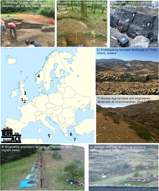
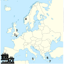
To date the project has seen extensive fieldwork in the UK and Italy. This includes the full archaeological excavation of a sequence of 5 Prehistoric terraces in Northern England (Ingram Valley), and sampling from ongoing excavations at Amesbury (Blick Mead), Sussex (Charlton Forest) and most recently Castronovo in Sicity. This typically involves Lidar acquisition, UAV and/or TLS survey, field measurement of mineralogy using pXRF and sampling for dating (OSL, pOSL, 14C), microfossils (phytoliths), soil formation (micromorphology) and molecular fossils (sedaDNA). Additionally sites have been scoped in the SW Alps, Norway, Liguria, East Crete and Tinos (Cyclades) and fieldwork is about to take place in Belgium and N Italy.
The Southampton components have include field survey and sampling soils for micromorphological studies and at a later stage GeoData will be an integral part of communication with FAO and stakeholders.


