 Professor Jadu Dash
Jadu Dash is a Professor in Remote sensing in the School of Geography and Environmental Science at the University of Southampton, UK. He has a strong international reputation in mapping, monitoring and understanding ecosystem processes using Earth observation data. He works closely with the European Space Agency’s Sentinel satellite programme and support the mission performance centre. His research focus on developing algorithms to estimate biophysical variables form satellite data, application of space-time techniques to characterise environmental processes. He has a strong experience of working in developing countries including projects in Africa, South East Asia and Caribbean investigating issues around food security, disaster response and impact of climate and environmental change on livelihood of the poorest community.
 Philip-Neri Jayson Quashigah
Philip-Neri’s research focuses on nearshore coastal dynamics and coastal erosion with the application of remote sensing/GIS and numerical modelling. His research also encompasses climate change impacts such as vulnerability to sea level rise. He has previously worked on the Deltas vulnerability and climate change; migration and adaptation (DECCMA) project and the US Navy/ONR West African Coastal Continental Shelf Processes Project. Philip-Neri holds a Ph.D in Marine science (University of Ghana). His thesis focused on measuring and simulation shoreline morphodynamics in the Volta Delta of Ghana. He also holds an MPhil in Environmental Science and a BA in Geography and Resource development both from the University of Ghana. Currently he serves as a marine scientist on the project, Beach dynamics through video monitoring to improve management strategies in West Africa (BEACHMON).
 Miss Yanna Alexia Fidai
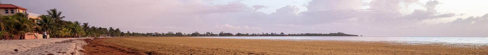
Yanna Fidai’s PhD topic explores the impact sargassum seaweed has on the livelihoods of varying communities across the Tropical Atlantic Basin. In recent years, large floating matts and mass strandings of seaweed on beaches have affected communities in different ways with notably negative impacts on tourism, aquaculture and biodiversity. Through this research she aspires to aid communities in managing and planning for these sargassum related events. She also aims to explore how GIS and remote sensing based methods can be utilised to support the affected communities in monitoring and management of sargassum seaweed.
 Sien van der Plank
WP2 and WP4. Sien van der Plank has researched environmental management across conservation, politics, mining and hazard contexts since 2015. This has included mixed-methods work on community perceptions of mining and mining consultations in rural Australia, and a discourse analysis of political party narratives on conservation in the UK, the Netherlands, Germany and Australia. More recently, she has analysed the challenges of coastal flood risk management in England across national policy, sub-national implementation and household perspectives and engagement as part of her PhD research with the Climate Change and Energy research group, Faculty of Engineering and Physical Sciences, University of Southampton. She is versatile across quantitative and qualitative methods, having practiced and developed past research through literature review, policy analysis, qualitative interviews, thematic analysis, household surveying, and descriptive and inferential statistics.