A team from the University of Southampton has successfully obtained the largest continuous visual map of the seafloor ever obtained in UK waters during a currently ongoing expedition to the Darwin Mounds. The expedition led by co-chief scientists Blair Thornton of the University of Southampton and Veerle Huvenne of the National Oceanography Centre (NOC), deployed underwater robots to map cold-water-coral mounds at a depth of 1000m in a Marine Protected Area (MPA).
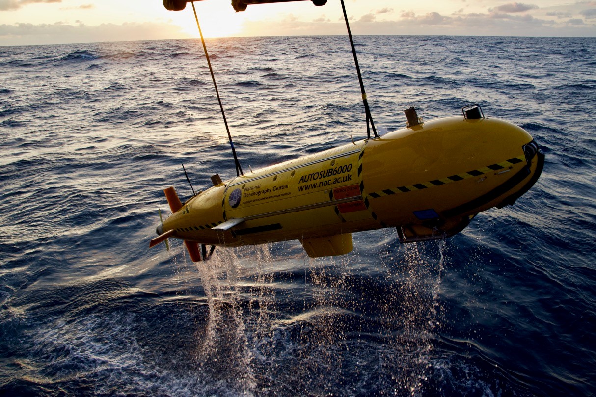
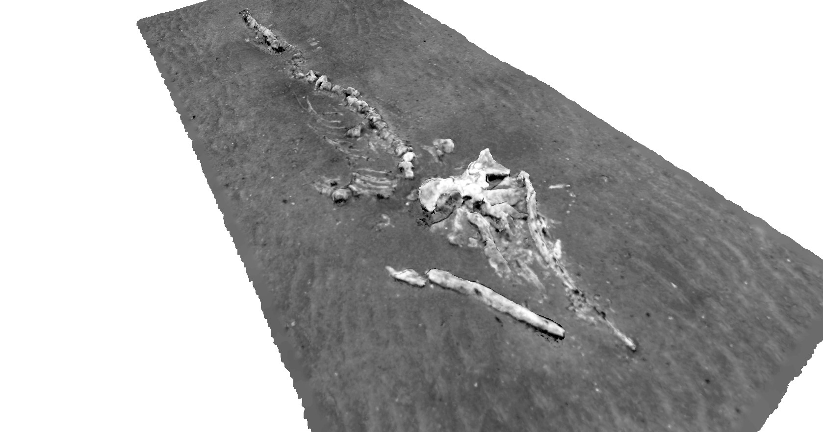
The autonomous robot, Autosub6000 of the NOC, was equipped with BioCam, a newly developed deep-sea 3D imaging system developed by the University of Southampton under the Natural Environment Research Council’s OCEANIDS Marine Sensor Capital program. During its first 24-hour deployment, BioCam was able to visually map the seafloor at 40 times the rate of conventional imaging systems, covering approximately 50 times the area of Wembley stadium’s football pitch. The example below shows one of the 650,000 images taken during the dive, showing diverse species of deep-sea life sheltering amongst the corals. BioCam also discovered a whale carcass more than 8 metres in length on the seafloor just a few hundred metres from a coral mound.

Blair Thornton, Associate Professor of Marine Autonomy at the University of Southampton says, “The large area and high level of detail in the visual maps BioCam collects can help scientists recognise patterns and features on the seafloor that would otherwise go unnoticed, allowing ecologists to compare sites and document changes over time at much larger scales than previously possible.”
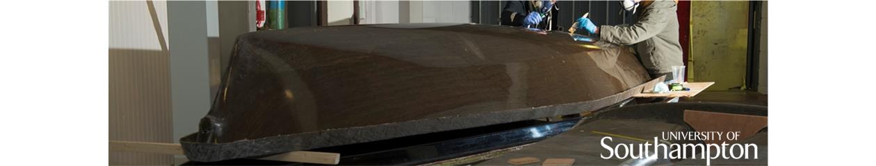
He continues, “It is fantastic that the system delivered results from the word go. This was only possible because of a huge team effort, with staff and students at the University of Southampton, local industries, and the MARS team at the NOC working hard together to develop BioCam and integrate it onto the Autosub 6000. Huge credit also goes to the ship’s crew for safely deploying and recovering the system in less than ideal sea states.”
Veerle Huvenne, Team Leader for Seafloor and Habitat Mapping at the National Oceanography Centre explains “typically, scientists map out large scale spatial patterns in ecology by inferring relationships between sonar maps and short transects of visual imagery (photographs or video). BioCam’s ability to continuously image areas in 3D over tens to hundreds of hectares gives us the ability to directly observe patterns over entire habitats. This is a powerful new tool for scientists to better understand these fragile environments”.
Hayley Hinchen, Marine Habitats Monitoring Manager at the Joint Nature Conservation Committee says, “The data BioCam collects could support marine conservation by providing vital evidence at a large scale about how effective measures like marine protected areas are at conserving our environment, especially in fragile, complex habitats that can’t be physically sampled. The evidence gathered could help us understand how damaged areas of the seafloor recover with time in protected sites like the Darwin Mounds”
More information about BioCam can be found at the following website, https://ocean.soton.ac.uk/biocam
Regular updates about the current expedition are posted on www.projects.noc.ac.uk/class/blog
Link to BBC article – https://www.bbc.co.uk/news/uk-scotland-highlands-islands-49753440