Currently browsing tag

Theban Harbours and Waterscapes Survey

Between the Desert and the Nile. Theban Harbours and Waterscapes

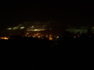
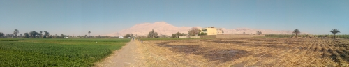
The West Bank of Thebes 
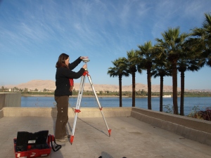
Back in 2011 the Theban Harbours and Waterscapes Survey (THaWS) started with a field season of geophysics. This Egypt Exploration Society project (www.ees.ac.uk), directed by Dr Angus Graham,Β  was established with the aim of using different techniques to study the settlements and temples on the east and west banks of the Nile, and how they relate to the changing floodplain and river. Continue reading →

Theban Waterscapes and Harbours Survey THaWS 2014 – Measure for Measure

The current season of THaWS fieldwork has given the team some time for reflection on the survey results from 2012 and 2013, and has provided an opportunity for addressing some of the outstanding issues related to the mapping of Thebes on the west and east banks. Survey work throughout the 2012-2014 has been carried out by the team members, including the project director Angus Graham, who oversees the work with the Egypt Exploration Society (EES; http://www.ees.ac. Continue reading →

End of Theban survey and up to Antinoupolis

The internet connection at Sheikh Ebada near El Minya is terrible, so no blogging for the last week. This is the first time I have managed to get set up so there is plenty to write about. We finished the survey at Thebes on 7th February, and Angus and the team departed for the UK on the 8th. We caught up with some American colleagues before the end, and enjoyed an amazing view of the West Bank including Kom el Hetan, one of the focal points for the THaWS survey. Continue reading →

Geophysics at Karnak – Intensive GPR survey and the beginning of the end of the survey

The latest work on the THaWS project has been marked by the intensity of survey profiles and survey areas covered, andΒ  the fact that the team have been working almost exclusively in and around Karnak temple. The transition of the GPS survey from the West to the East Bank went smoothly, as reported in the last post. We established a base station on the roof of Chicago House on the West Bank, with the very kind permission of the staff. Continue reading →

Kom El Hetan, Thutmoses III and Karnak – from the West to the East Bank

A few days of work have happened since the last blog, and plenty has happened since the weekend. The team woke up on Monday to find that it had been raining all night in Luxor, and it continued until the middle of the morning. So much so in fact that a huge pool of water developed next to the flat entrance. The inadequate drainage meant that around 3pm a van turned up and pumped the water away. Continue reading →

Day Two at Kom el Hetan

More area to survey today behind the Colossi of Memnon on the West Bank. We started the day one person down, as Dom’s insides are still rumbling, possibly due to the Egyptian cuisine.Β  He stayed in to do some office work, and the rest headed out to cross the Nile. We continued the GPR survey behind the Colossi of Memnon, and ran two ERT profiles in front of the same. In addition Sarah’s search for survey stations from previous years continued with the GPS rover. Continue reading →

THaWS Project – Start of the week survey at Kom el Hetan

The start of another busy week in Thebes and the team headed back to the West Bank to commence GPR and ERT survey in the vicinity of Kom El Hetan and the Colossi of Memnon. The bus stopped however for a short visit to the impressive brickworks on the east bank to the south of Luxor. A massive chimney and a series of arched entrances leading to the kilns mark the site on the banks of the Nile. Continue reading →