Guest Post: Geophysics on Basingstoke Common – Clare Allen
Clare Allen has written a post updating us on her ongoing research for her Masters in Archaeological Surveying and Landscape major project.
—
The three weeks spent doing geophysics on the common were very eventful; from running away from cows to stomping down nettles. However, some very interesting results have been achieved, with a lot of archaeology being revealed on the common. Based on the nature of potential archaeology, the technique I decided to use was magnetometry. Using the OS data and GPS points the map (see the picture below) shows the full coverage of the survey.
Magnetometry is an efficient geophysical method used to measure the variation of magnetic properties of the soil. It is mostly suited to identifying highly oxidised material such as kilns, ovens, hearths, ditches and pits. This technique is heavily reliant on the presence of weakly magnetised iron oxides, usually through heating.
Chalk is one of the most responsive sub-soil types for magnetometry, influencing the quality of the results. Being located on chalk downland, this method was an ideal option for the Basingstoke area.
Results can also be heavily affected by the presence of magnetic items in the area such as pylons, overhead cables, fences and also on the surveyor. Thus the surveyor must always be completely metal free and the equipment must be kept at a distance to metal in the area.
This map shows the GPS points marking area covered by the magnetometry. The image uses EDINA Digimap Ordnance Survey Service, 2013.
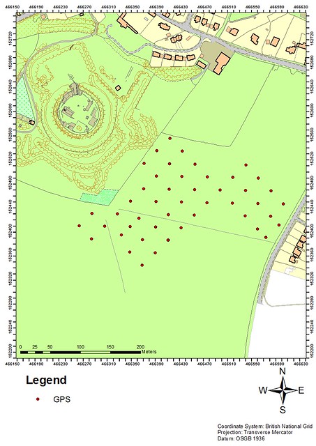
Shows the GPS points marking area covered by the magnetometry on Basingstoke Common. EDINA Digimap Ordnance Survey Service, 2013. Image produced by Clare Allen
Overall, the survey went really well, producing some great results. Both the undergraduate students and volunteers got the chance to learn the main principles of magnetometry as well as the practical aspect of how to use the equipment. Those who wanted the chance to use the magnetometer were given the opportunity to do so and picked it up really well.
Images of the magnetometer in use:

Dan and Vicky taking the mag across one of the grids on the Common.
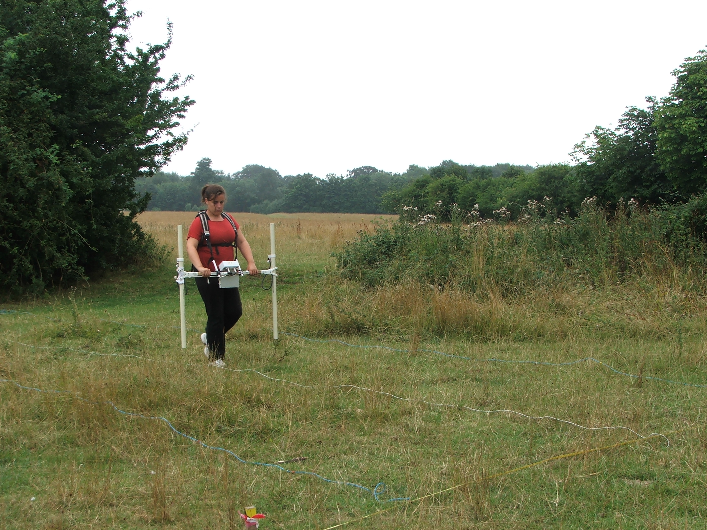
Clare using the mag on the Common. In this photo you get a good view of the ‘strings’. These are plastic line, marked at one metre intervals by tape.
Below is an image of the results that were collected over the three weeks. The results have not been fully processed as of yet and remains a bit patchy and fuzzy in some areas. However, the results have generally shown up some interesting features including the World War two anti-tank ditch. Using the results I will create digitised maps highlighting the archaeology and examine the defensive features within this data and the data collected over the spring survey.

Magnetometry data of Basingstoke Common; not yet fully processed. Image produced by Clare Allen
–
Clare Allen
Filed under: Clare Allen, Magnetometry Survey, Student Research Post, Summer Excavation, Survey Equipment Tagged: basingstoke, clare-allen, common, magnetometry, survey, world war two


